Over the Xmas holidays i had the chance to go walkabout for a few days and just pointed the truck south from Brisbane towards the mountains of the great dividing range and followed my nose with no plans on where to go.
I had my swag and a bit of food so all i needed was a small flattish spot to roll out my swag so i didn't have to worry about finding a place to camp.
The weather was lousy with grey skies and frequent showers but it was better than sitting at home.
I headed south on the "Highway to Hell", a narrow, twisty, rough and bumpy Bitumen road through the mountains...
Mt Lindsay looked good with a veil of clouds...

I took a side road up to Tooloom Lookout but theres too much growth to see anything...
Daggs Falls had a bit of water flowing but it was getting dark...
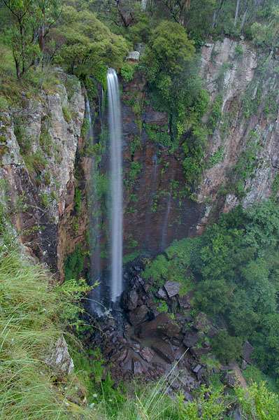
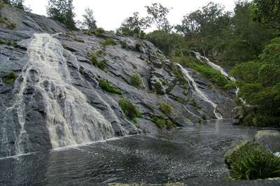
By the time i got to Queen Mary Falls the sun had set and made it rather gloomy...
I Realised that the sun would not be in the right position until late afternoon so decided to head to Warwick for fuel then drove down to near Bald rock and rolled the swag out beside a fence line late that night.
Next morning i headed over to the base of Bald Rock...

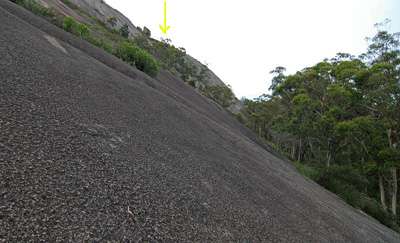
I puffed and panted, wheezed and coughed my way up to nearly as high as the trees before stopping to take a pic :)
the final destination is under the yellow arrow ...
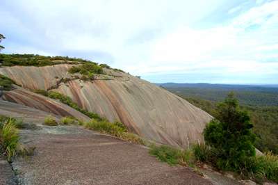
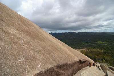
I finally managed to haul my sorry ass up the rock face and walked across to the other end on top of the multi coloured dome...
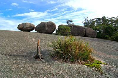
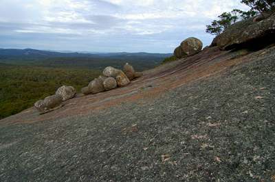
On the bare shoulder between the high points is a row of rounded rocks just waiting to go crashing over the edge...
This one on the end really got my attention as a great pic possibility...
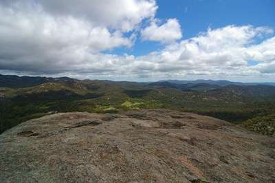
I walked on to the highest point...
where there is a marker cairn and a visitors book...
I circled the scrub at the top and saw these rocks somehow hanging on to the steep side of the dome...
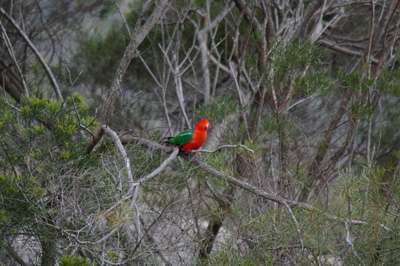
As i walked back to the other end i spotted a male King Parrot...
On the way back down from Bald Rock i took the easier path, the track passes through this tunnel...

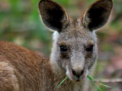
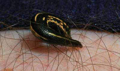
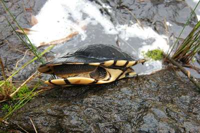
Not far past the tunnel i spied this little fella not far off the track...
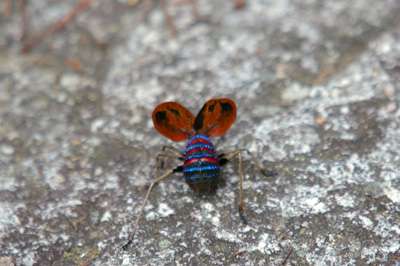
This dull brown bug put on a show of colour as a defence mechanism...
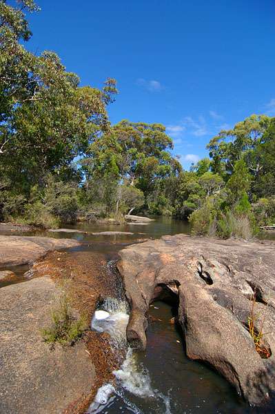
Once back to the truck i headed south again and turned left into Boonoo Boonoo national park for a look.
You can't see much of Boonoo Boonoo Falls through the trees ... this is the top half.

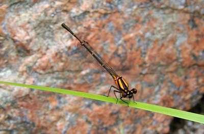
In the pool above the waterfall i found a damselfly...
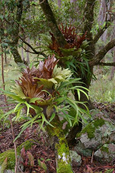
Lots of Staghorns in the area...
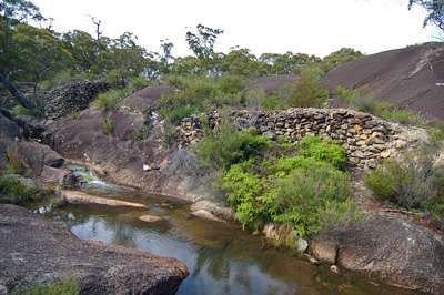
I stopped in at Morgans Gully and saw where they had hand carved a channel through the rock...
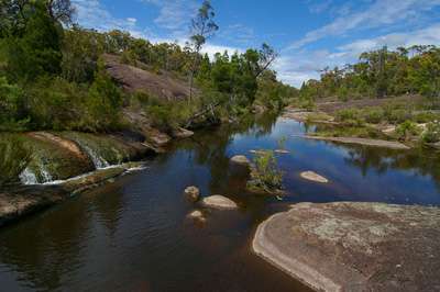
Then followed the creek down to where it dropped into the river in a small waterfall...
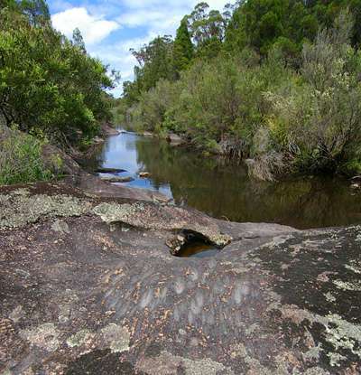
A little further up the river i found an Aboriginal spear sharpening area.
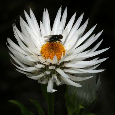
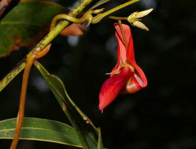
I left this area and headed south again then turned into Basket Swamp National Park and took a track up to Timbarra Trig and stopped beside this flower...
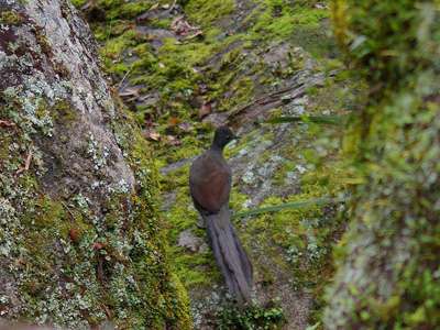
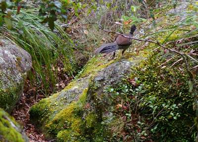
As i walked up near the top i could hear some strange sounds so i snuck up and managed to snap off a couple of pics of a couple of lyrebirds...
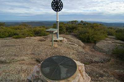
Timbarra Trig has an old rusty ladder up to it...

with one last view to the south i headed off up to the end of the main track...
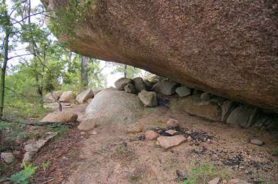
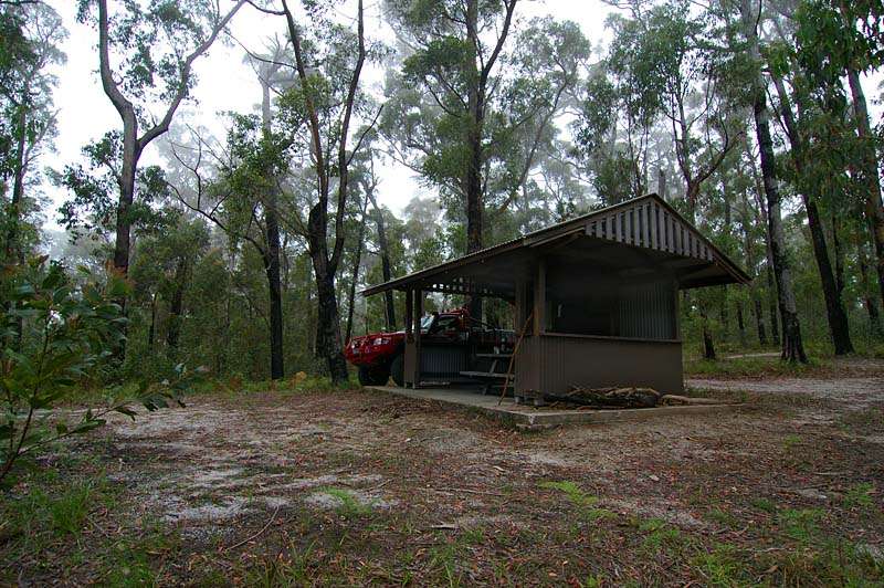
I found a great little Hut at the end so cleaned it up and collected some wood to keep dry before going for a walk to the nearby Rocks.


i followed the track past this interesting looking vine...
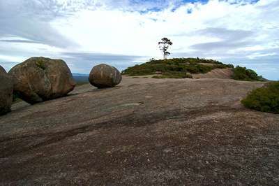
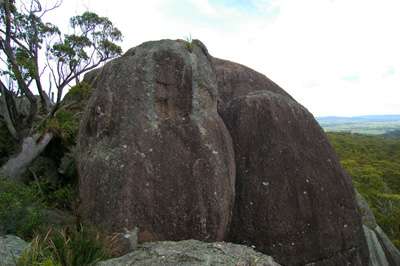
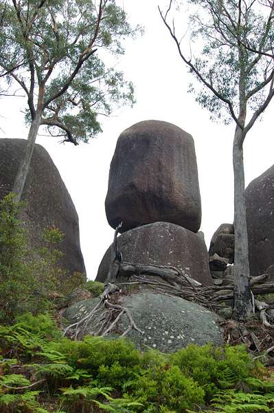
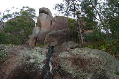
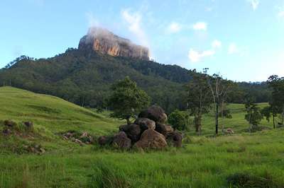
Woollool Woolloolni is an outcrop of large boulders that can be seen for miles
looks like someone has camped here in the past...
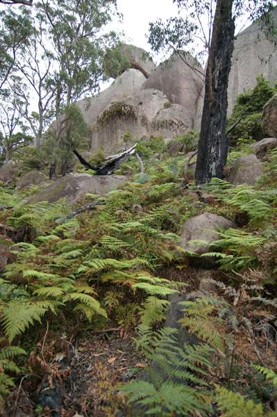
there are some huge boulders stacked up...
Leeches were a bit of a problem though...

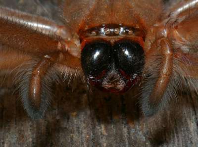
Back at the hut i got this shot of a spider...
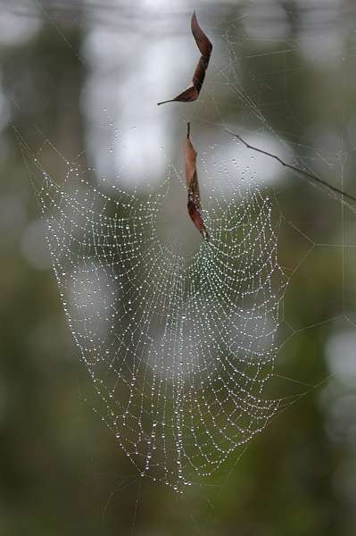
Early next morning the Hut was surrounded by an eerie mist...
The early morning mist clings to the spiders webs...
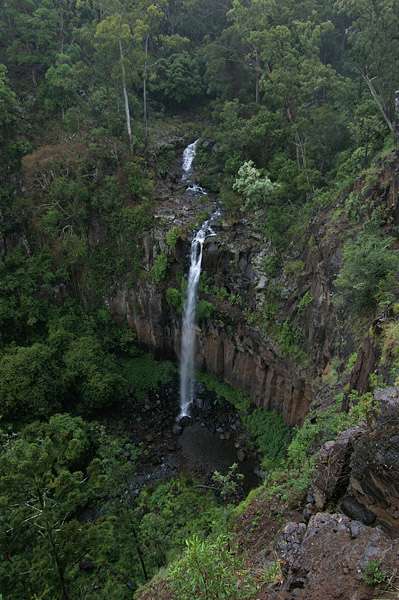
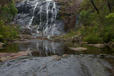
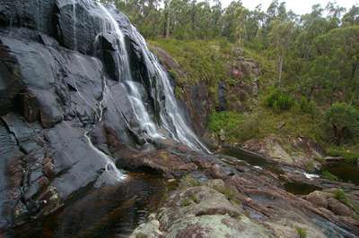
I cleaned up the rubbish and headed to Basket Swamp Falls where i found these strange water jets coming out of the rock...

I found my way to the bottom of the falls and grabbed a couple of pics...
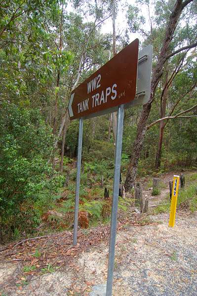
To the north of Tenterfield is the "Brisbane Line" a line drawn which was to stop the Japanese invasion in WW2, these Tank Traps were a series of wooden poles in the ground as part of the fortifications.
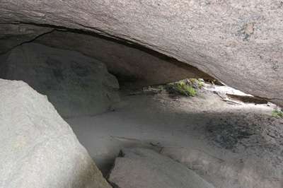
Just down the hill a bit is Thunderbolts hideout, this is one of the many Caves in the rocks...
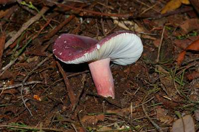
hidden in one of the crevices was this strange coloured mushroom...
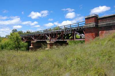
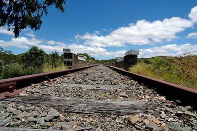
I travelled to Tenterfield for lunch then headed north passing this old railway bridge...
When i arrived at Girraween National Park i went and had a look at The Arches first...

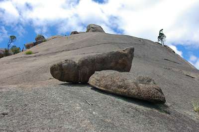
On the way up the Pyramid you can see some balancing rocks...
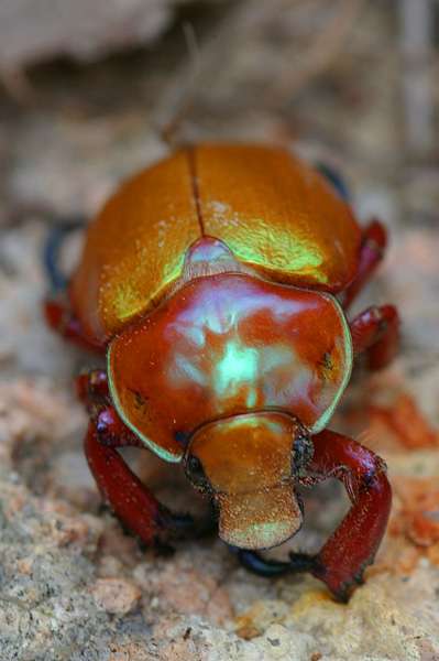
And some multi coloured bugs...
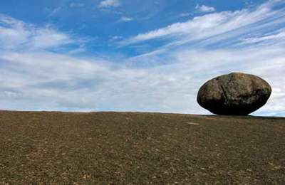
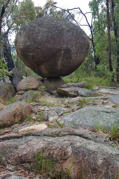
The climb to the top of the Pyramid is up a large bare granite rock face...

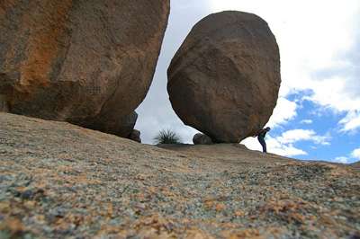
At the top is a balancing egg shaped rock...
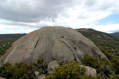
You can look over to the next dome...
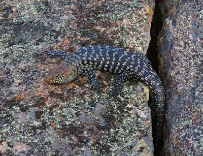
over the back section i found a Cunninghams Skink sunning itself...
from the very top i looked over towards Castle Rock...
The track follows the gap where one section of rock has split started to slide over the side dwarfing the people in it...
Back down near the Carpark the creek has carved some interesting shapes in the granite...
I Decided to head for home but saw a sign to Undercliffe Falls and headed down for a look, it was raining making the climb down into the valley "Very Interesting" ...
I found this little fella stuck in a cleft in the rock and placed him at the waters edge but he didn't want to come out for a pic...
Once again i started for home passing Mt Lindsay in the golden light of late afternoon...
With the view of Mt Lindsay in the mirror i finally headed for Home!


3 comments:
Excellent pics, brief but well thought out narrative - all of which has made me 'bookmark' this area for a trip myself - well done
You need to write a book... GOGOGO!!
Brilliant... As usual :)
Thanks Terry, Thanks Angie, glad you enjoyed it :)
Post a Comment