On a side note ... after yesterdays effort and last nights sleep i'm in a world of hurt ...
Can hardly move but its just aching, no intense pain.
takes five minutes to get out of the Ute ... LOL
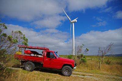
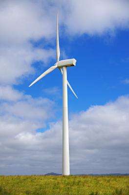
Thursday 29-12-11 I started heading towards the High Country and saw these in the distance so thought i would go have a look ...
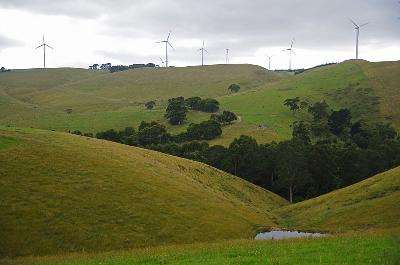
sure are big buggers
and thats one of the small ones ..
but at least i didn't have to walk far ... LOL
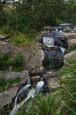
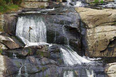
I saw a sign for Agnes Falls so went and had a look at them ... apparently they are the highest falls in Victoria sure don't look very big!
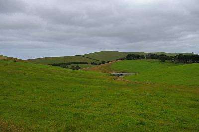
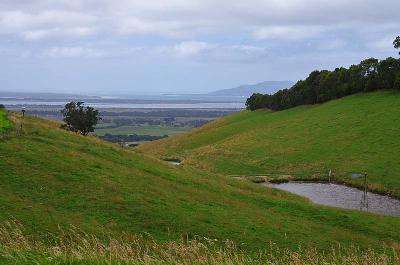
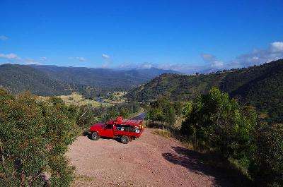
some nice views on the way back down to the highway ...
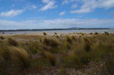
Following along the coast i spotted this old Pier ...
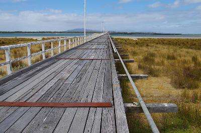
sure goes out a long way ...
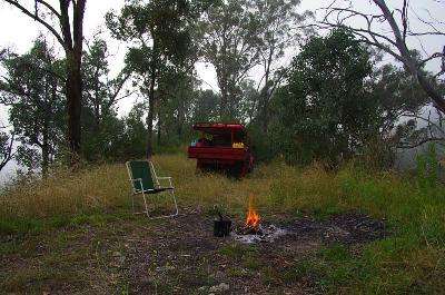
Last night was the first chance i've had to have an actual campfire
Also found a big hand held spotlight someone had left behind
found a little side track near Licola ...
Devils Elbow ...
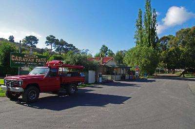
Topped up with Diesel at Licola ...
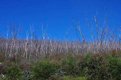
Heading towards the Pinnacles i passed lots of dead trees from the fires ...
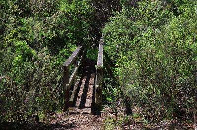
I walked in to Moroko Hut crossing a little wooden bridge ...
Moroko Hut ...
Next up i passed Horseyard Flat Hut ...
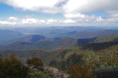
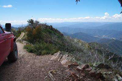
Currently having a look at The Pinnacles and posting as there is a good signal up here ...
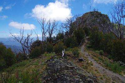
Not a bad view from up here ...
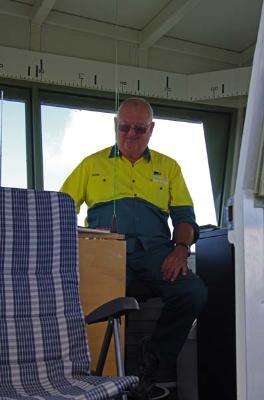
The Ranger on fire lookout ...
Looks like i'm heading down this way ... sounds interesting apparently!
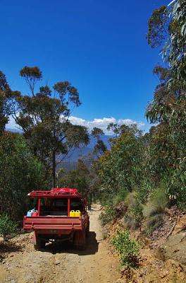
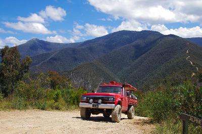
Leaving the Pinnacles i turned left into Billy Goats Bluff track passing a couple of cars just before the down hill started ...
the track follows the ridge line down down down ... i was in first low with the brakes on for a lot of the track ... man its steep ... and a bloody long way ... a bit shorter if you fall over the side though ... LOL
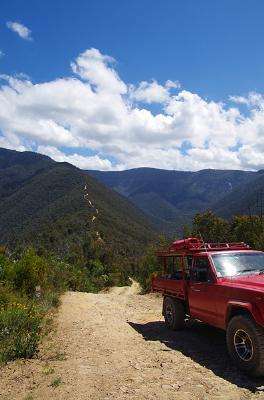
This is up near the top and your heading to the flats at the bottom on the right of the pic...
Off i headed ...
About two thirds of the way down you come to a bare Knob where the track turns sharp right ...
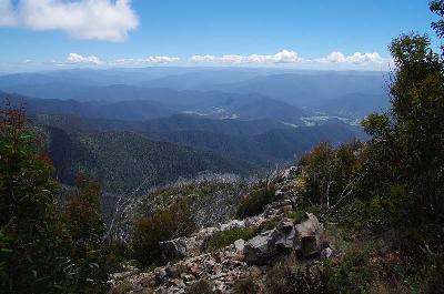
You can see the Pinnacles up to the top left ...
The track you follow down is very steep, rough and rocky so traction was pretty good ... i had to keep it slow though as the leaf springs tend to start dancing across the top and it pick up speed in a hurry
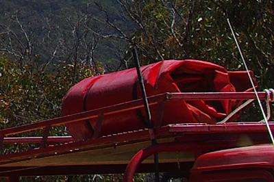
Sadly ... somewhere after this i lost my swag ...
You can see that the swag has slipped out of the ropes and turned to the side but i didn't notice it until i got to Wonnongatta ruins a few hour later.
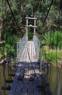
While looking for the Eaglevale Track i spotted an old swing bridge that leads to Dungeys Hut ...
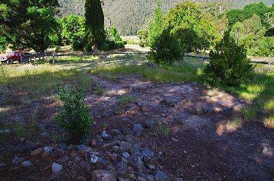
Just downstream is a River crossing so i took that and was soon climbing the range to Cynthia Range Track where i turned left and followed it to Wombat Spur track and was soon at the ruins of the old Wonnangatta Station ruins...
not much left of the old homestead now ...
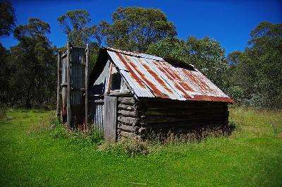
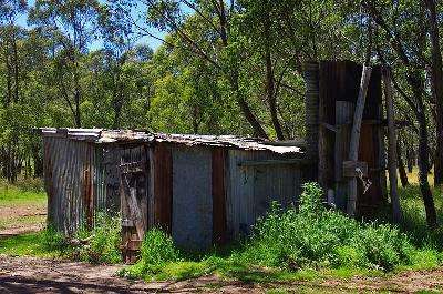
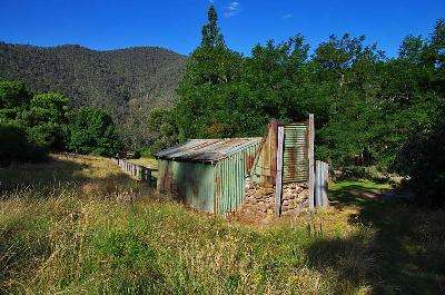
There is a hut there though ...
And the "Friends of Wonnangatta" mob make sure the Cemetery is well kept ...

It was about now that I discovered my missing swag and a quick look back through my pics showed it was still on the roof way back at the Helipad on Billy Goat Bluff so i headed back.
When I crossed the river at the swing bridge a couple of campers reckoned there was nothing on the roofrack when I crossed so I kept going all the way back to the Helipad with no sign of it
Bugger, no where to sleep now and the ranger at the Pinnacles said it was 10 degrees the night before so i took the track towards Dargo then down to Beaconsfield to refuel body and Ute ... I had intended on driving a fair way overnight but got sleepy so made my bed on a pile of grass clippings someone had dumped at a roadside stop.
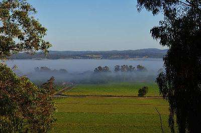
Next morning had me thinking "no bed sucks" so I set the Nav for home and headed towards Cann River passing some fog filled valleys ...
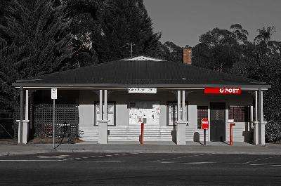
I turned left at Cann River passing an old Post office ...
Driving along i saw a shortcut towards Jindabyne and thought "Kosciuszsko ... never been there, ain't gunna make it home before bed time anyway, how hard can it be?" LOL
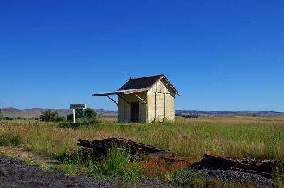
so I turned left passing an old Railway siding at Jincumbilly ...
I passed through Dalgetty crossing the Snowy River...
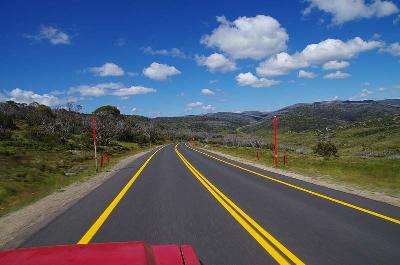
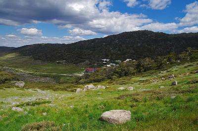
I stopped and paid my entrance fee [$16.00] at the park entrance then hit the winding road up into the mountains as far as i could drive to Charlottes Pass where i had a bit of trouble finding room to park in amongst all the other tourists
I watched as a group of superfit Ladies limbered up all dressed in their special hiking boots, lycra pants, moisture wicking shirts, lightweight daypacks and impressive walking sticks ...
I set off on the walk, 9 Km to the top but the scenery is pretty impressive and the walking was on a "management only" road.
A couple of Kms later i thought "bugger the knees, i can pass them" so i picked up the pace and a couple of K's later finally passed them with a cheery hello ... pfft ... who says a seriously unfit 55 year old bloke in steel cap work boots, king gee work pants, a Papa Smurf tee shirt and one of the kids old school bags can't outpace a bunch of ladies who obviously do this sort of thing quite often
[OK, the youngest was about 80 LOL ]
Then, off in the distance, i could see a group of mid 20's hikers with well used but good quality gear walking like they do in the Olympic walking races so i set my sights on passing them too
I picked up the pace and as i got closer the knees were giving me hell as i climbed steadily but i held my back straight and plowed on giving them a smug nod as i passed them [ on their downhill walking the other way LOL ]
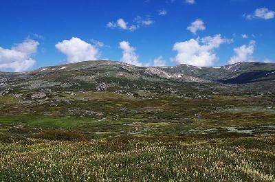
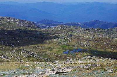
I was surprised that it was only a series of rolling hills and although i could not see the summit yet it did look like there was some snow around.
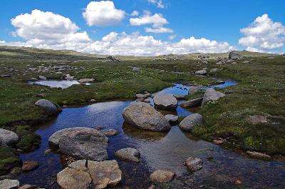
At the half way point you cross over the Snowy River ..
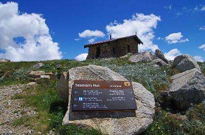
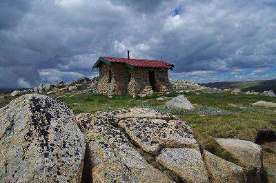
There is Seamans Hut on the next ridge ...
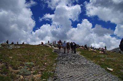
With only 2 Kms to go you could see lots of people on top of the summit
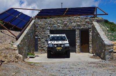
They have built an underground structure at Rawson Pass which includes public toilets ...
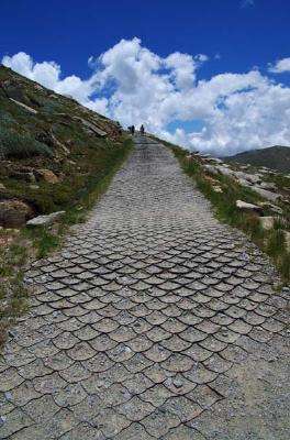
From here the track gets a bit steeper and they use that stupid plastic mesh which would be ok if they kept it full but it sticks up an inch or so waking it easy to trip on and when you step on it it folds over ...
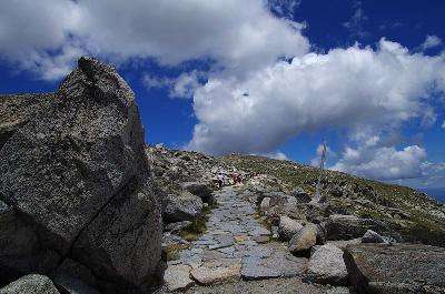
Then it changes to paving with flat rocks and even a small section of steel mesh grid
As i neared the top several hundred Crows flew noisily over head as if to trumpet in the victorious lone hiker's momentous achievement ...
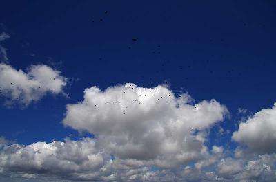
or maybe they just like being part of the crowd
I waited for a gap in the crowd but there were never less than a hundred or so people milling around so had no chance of a nudie pic
It was hard enough just getting to one of the four sides of the marker
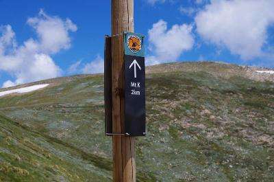
Any way ... i had reached the highest point in Australia at 2228 Metres
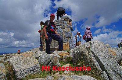
[I wonder when they're gonna rename it? ]
Well you know what they say ... "It's all downhill from here"
The right knee was playing up a bit but not too bad so i headed off back down the track and it wasn't long before the left knee gave way and i had to put all the pressure on the right knee
I was trying not to have my knees straight which was a huge strain on my calf muscles and before i got back to Rawsons Pass my left Hip started killing me ... this was not looking good.
I stopped at some snow for a pic ...
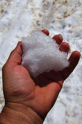
The streams start off very small up here ...
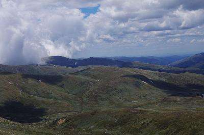
The weather was looking a bit darker as i passed by Seamans Hut again...
And by the time i reached the Snowy River it was looking a bit ominous ...

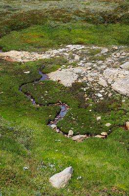
4 Km from the very start of the 500 Km long Snowy River and there are lots of small fish in it ...

The track was a lot gentler now so i just kept plodding along stopping at every opportunity for a picie break
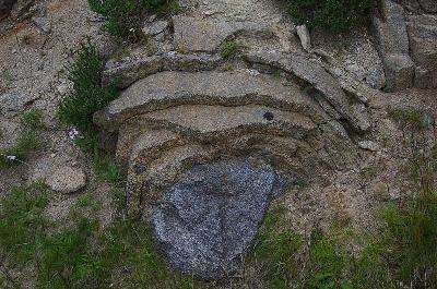
A layered rock ...
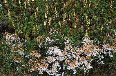
Alpine bush and flowers ...
Then with 2 Km to go the Ranger came up behind me in her Hilux so i gingerly moved off the track onto the slope which made me limp even worse so as she pulled up beside me she asked "do you want ..." and finished with "a lift" as i sat down in the passenger seat ... LOL
She dropped me at the carpark above the Charlottes Pass lodge
and i hobbled back to the Ute and a welcoming coffee
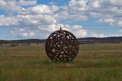
I hit the road for home passing ... errm ... this thing in the middle of nowhere ???
Luckily it was pretty quiet traffic as i passed through Sydney on New Years Eve and pulled up just after Midnight ...
let me tell ya, sleeping on gravel is no where near as comfortable as grass clippings
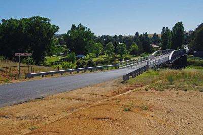
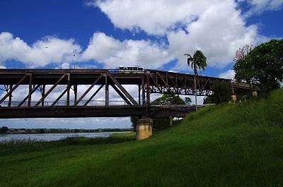
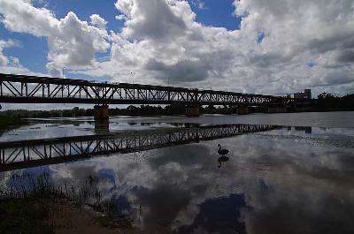
Next day I stopped for a piccie break at the double decker bridge at Grafton
Then it was just a boring run up the Highway to home.
In a week i had seen
.The Most Eastern Point of Australia.
.The Highest Waterfall in New South Wales.
.The Most Southern Point of Australia.
.The Highest Waterfall in Victoria.
.The Highest Point in Australia.
I had also spent Christmas with the family
Not a bad week at all :)
