Sunday, November 22, 2009

The most Southerly point of Qld .

Sometimes all you need is an excuse to get away for the weekend and this one came to me while looking through some photos of the places I've been in Queensland.

I have been to the most Northerly point at Cape York, the most Easterly point at Point Danger, the most South Westerly points at Cameron Corner, Haddon Corner and Poepel Corner but haven't been to the Northwest point or the most Southerly point and since the South point is close enough for a weekend trip I started doing some research.

Nothing! ... I could find absolutely nothing about it so started checking out some maps and found two possible points with a variance of only ten metres or so according to the water in the Dumaresq River, further research found that the actual border between Queensland and New South Wales falls half way between the banks so it really depends on how far apart the two banks were at the two different places.

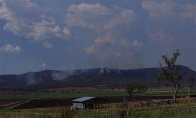
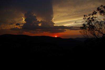
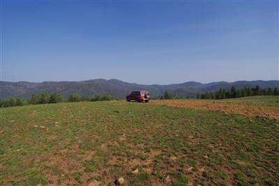
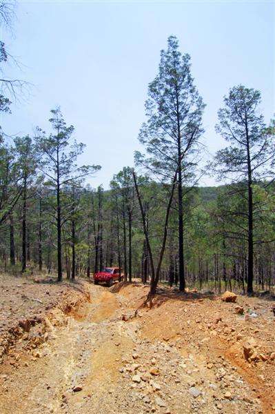
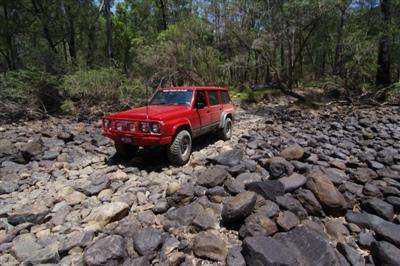
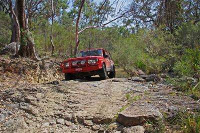
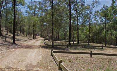
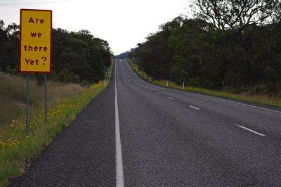
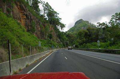
Setting out from Brisbane in a bit of a heatwave I headed Southwest where after crossing Cunninghams Gap I passed some Bushfires just to the South.
Image Hosted by ImageShack.us

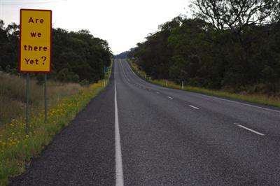
The 250Km of bitumen to Sundown National Park seems to take forever in the hot weather with no aircon.
Image Hosted by ImageShack.us

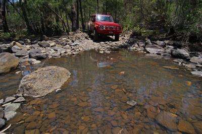
After spending a night in Sundown I headed the 35Km to Tenterfield where I turned right for Mingoola about 70Kms away.
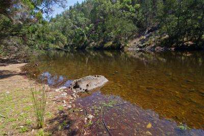
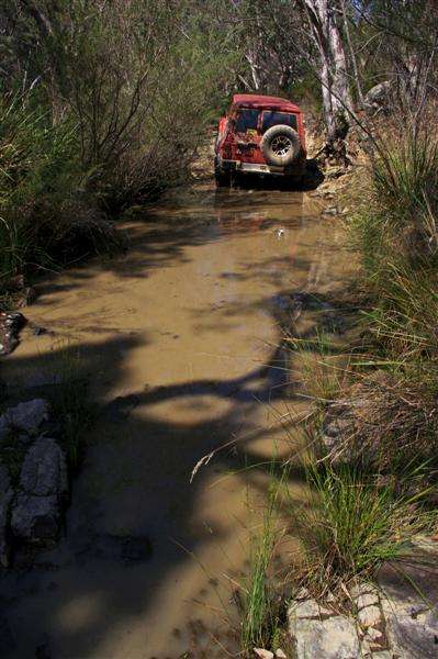
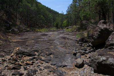
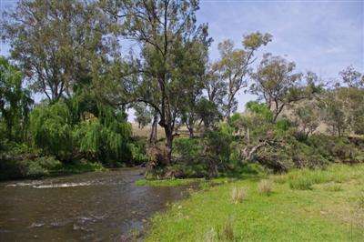
8Km past Mingoola I needed to turn right over the Hynes Bridge to cross the Dumaresq river back into Queensland and started checking how far south I was, It wasn't long before I found the area close to the Eastern possibility and walked across to the nearby River to check it out.
Image Hosted by ImageShack.us

Image Hosted by ImageShack.us

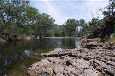
The Eastern possibility is quite easy to work out as the Southern bank is about 5 metres and the Northern bank is about 4 metres above the water level.

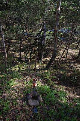
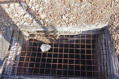
While traversing back and forwards along the river banks I finally found the most southerly point of the Southern bank and discovered a U shaped piece of metal hammered into the ground straight north of it on the northern bank at
S 29.10.652 E 151.23.635

Could this be the point I was looking for?
Image Hosted by ImageShack.us

The sun was getting low as I walked back across the paddock to the 4WD.
Image Hosted by ImageShack.us

As I drove to the top of a hill I realised I would not have time to find the Western possibility that day.
Image Hosted by ImageShack.us

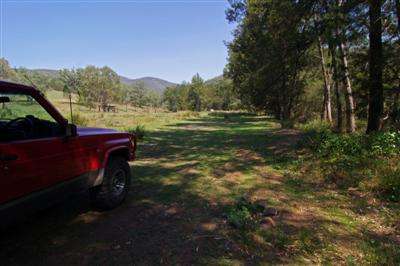
I needed to find a campsite quickly and headed off towards the Western possibility.
Image Hosted by ImageShack.us

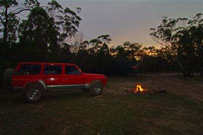
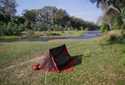
Luckily the river runs close to the road giving access to the river bed and a great campsite only 750 Metres from my goal.
Image Hosted by ImageShack.us

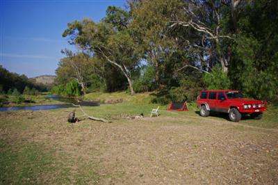
I had set the swag up in mossie mode as the temp was still 38C at 10.30 that night and I needed all the breeze I could get.
Image Hosted by ImageShack.us

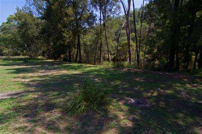
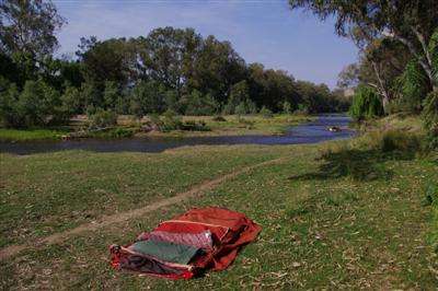
I packed up camp and started getting ready for a walk to the point in the far distance down the river.
Image Hosted by ImageShack.us

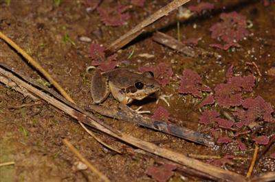
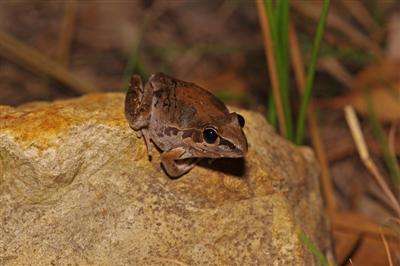
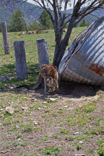
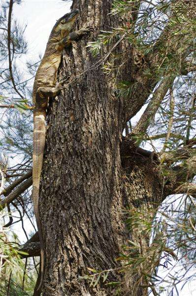
As I scouted along the bank i disturbed a Goanna.
Image Hosted by ImageShack.us

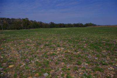
As I walked towards the Western possibility it became clear that this would not be so easy as there appeared to be a few banks on the Northern side, starting from the river opposite the most Southerly part of the South bank, there is a 2 metre high bank of mostly sandy material covered in trees and bushes then the land drops a metre or so and starts a gradual rise in a Northwards direction towards another 2 metre bank at the fence line about 300 metres away, this area is mostly grass covered small stones and sand and would only go under water in rare floods, according to one old timer I met the last big change happened in the 1974 floods.
Image Hosted by ImageShack.us

The river passes a tree on a small island just on the other side of the bank.
Image Hosted by ImageShack.us

It looks like i will need some clarification on which bank to use.

Then it was time to head back to the 4WD and headed for home.
[via the southern end of Sundown National Park]

I did some more checking with various Govt departments and old papers as well as getting a copy of
"Redefining the Queensland-New South Wales Border: Guidelines for surveyors"

I found a little snippet of information that the position of the border is based on the position of the banks in 1859 and property boundries have remained unchanged.

"The bank must be defined in accordance with common law principles that were in affect at the date of the letters patent in 1859"

So looks like another trip down is in order !!
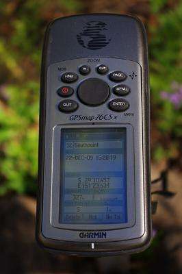
22-12-09:

Once again i headed up over Cunninghams Gap on the way to Mingoola ...
Image Hosted by ImageShack.us

Arriving at the Western possibility i headed out to the spot where the Dumaresq river reaches its most Southerly point and waded across the river to the Southern bank.

I found the most Southern bank and took a measurement S29.10.782 E151.20.325
I then walked the 438 mtres to the Northern bank at S29.10.545 E151.20.325
Then i found the boundary at S29.10.663 E151.20.325

On the way back to the car along the riverbank i nearly jumped on a black snake as i climbed up on a stump to make jumping over the fence easier ... luckily it took off for the waters edge and the long grass.

Next up i headed back to the eastern possibility a few Kilometres away.

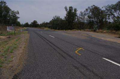
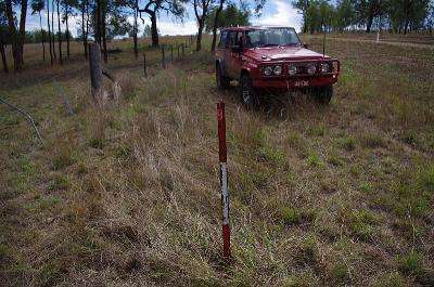
I found the marker post at S29.10.349 E151.23.561 and parked the car...
Image Hosted by ImageShack.us

I crossed the paddock and then waded across the river to find the most southerly point of the south bank at S29.10.725 E151.23.575

As the river turns very sharply to the North the closest Northern bank is to the northeast so i found the most southerly part of the Northern bank at S29.10.653 E151.23.634 which makes this spot the Southernmost point of Queensland.
Image Hosted by ImageShack.us

[Just for interest sake the northern bank directly north of the southernmost bank is located at S29.10.614 E151.23.575]

The Border point is located in the water at S29.10.689 E151.23.605

I hammered in a marker post at the Southernmost point to mark the occasion then backtracked to the car and headed off to Victoria for Xmas.
Image Hosted by ImageShack.us

Sundown National Park

Sundown National Park is around 250Km southwest of Brisbane and comprises two sections, the North Eastern section is for 4WD's only while the South Western section is suitable for 2WD's.

Leaving Brisbane I travelled up over Cunninghams Gap and onto the Darling Downs passing several bushfires along the way.
Image Hosted by ImageShack.us

The main highway leads you to Ballendean where you make the turn for Sundown
Image Hosted by ImageShack.us

The road wanders through private property before coming to the gate leading into Sundown National Park
Image Hosted by ImageShack.us

I drove up to Red Rock Gorge and walked down to the lookout
Image Hosted by ImageShack.us

I was treated to a magnificent red sunset over the gorge.
Image Hosted by ImageShack.us

Image Hosted by ImageShack.us

The small dam at the camping area was alive with several different frogs
Image Hosted by ImageShack.us

Image Hosted by ImageShack.us

Image Hosted by ImageShack.us

The camping area has a toilet but no fences ... great spot to spend the night :)
Image Hosted by ImageShack.us

Next morning i packed and after a bit of a walk around the place, headed out.
The track leads past the old Beacroft Mine which has been fenced off but allows a close up view of the shaft as it drops into the depths.
Image Hosted by ImageShack.us

The cleared areas allow a fantastic view of the surrounding hills
Image Hosted by ImageShack.us

This Prickly Pear was actually growing out of the top of an old fence post
Image Hosted by ImageShack.us

I took the right fork and headed down the hill, the area used to host cattle so there are quite a few old yard left around
Image Hosted by ImageShack.us

The track stops at Reedy Waterhole and with the hot day and lukewarm water i couldn't resist a swim although the rocks are very very slippery.
Image Hosted by ImageShack.us

I backtracked then turned right and headed for Burrows Waterhole where i again jumped in for a swim.
Image Hosted by ImageShack.us

There are some nice shaded campsites along here right next to the Severn River.
Image Hosted by ImageShack.us

Image Hosted by ImageShack.us

When i tried to climb the steep rutted hill towards Hell Hole i broke an engine mount and shorted out the fridge wiring so had to disconnect the battery and carefully reverse off the hill.
Image Hosted by ImageShack.us

I crossed towards Rats castle and found a shady spot to make some repairs.
Image Hosted by ImageShack.us

Image Hosted by ImageShack.us

A ratchett strap around the chassis held the engine down as i had a fairly rough climb coming up as i neared Burrows Waterhole.
Image Hosted by ImageShack.us

We made it back up the hill and i stopped at the old yards on top of the hill to check over everything and have a look around.
Image Hosted by ImageShack.us

Image Hosted by ImageShack.us

This Old Roo was not about to be moved along easily from his shady spot under the old watertank.
Image Hosted by ImageShack.us

On the way out of the park i took the "Lower Track" back to the park entrance, this track is much more interesting than the main "Upper Track"
Image Hosted by ImageShack.us

Image Hosted by ImageShack.us

Image Hosted by ImageShack.us

Sundown is a place where it is very cold in winter and very hot in summer but its good fun for a weekends camping and exploring.

The 2WD section:

After a day down at Southpoint i decided to check out the 2WD section at the south west end of Sundown National Park.

There is and old homestead and some old equipment just opposite the Ranger Station at the entrance to the park.
Image Hosted by ImageShack.us

Image Hosted by ImageShack.us

Not far away is the Broadwater Camping area and end of the track, I'm afraid the fenced in area doesn't really do it for me :(
Image Hosted by ImageShack.us

I decided to take a walk and have a bit of a look around, the track followed the fence for quite a while.
Image Hosted by ImageShack.us

There was no water at all in Ooline Creek.
Image Hosted by ImageShack.us

Permanent Waterhole on the Severn River still had plenty of water so i took the opportunity to have another swim.
Image Hosted by ImageShack.us

Back at the campsite there is an old Donkey Boiler.
To operate you fill it to the top with water and light the fire under it then when its hot you pour some more water in the funnel and it flows out into the metal bucket which you then carry to the shower cubical and fill the shower head, then just hoist it up and your away. :)
Image Hosted by ImageShack.us

Image Hosted by ImageShack.us

I passed the old homestead again on the way out.
Image Hosted by ImageShack.us

The campsite are all right beside the road so you would be getting pretty dusty so i would much prefer the 4WD section.
Still ... anywhere is better than sitting at home :)

4WD section:


2WD section: