
"The great walk" runs from O'Reilly's on Lamington Plateau to "The Settlement" at Springbrook, a total of 54 Kms
Check out the link for more info:
http://www.epa.qld.gov.au/parks_and_forests/parks/gold_coast_hinterland_great_walk.html
==========================================================
:Green Mountains (O'Reilly) to Binna Burra - 21.4km (7 hours) Class 4 (Moderate)
Begin your walk from Green Mountains section of Lamington National Park along the well-known 21.4km Border Track, which links Green Mountains section of the national park to the Binna Burra section.
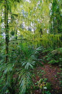
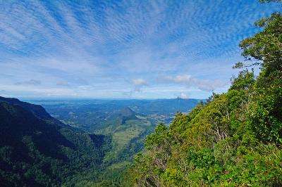
The Border Track traverses some of the highest remaining basalt lavas from the Tweed Volcano. With increasing elevation it passes from warm and cool subtropical rainforests into warm and cool temperate rainforests . Lookouts along the Border Track are on the rim of the Tweed Valley erosion caldera and on a clear day you can see Mount Warning, the distant Nightcap Range, the Lamington wilderness area and the Tweed Range.
:Binna Burra to temporary Woonoongoora walkers' camp - 19.5km (4-5 hours) Class 4 (Moderate)
Begin at the Ships Stern track and Lower Bellbird circuit entrance, below the Binna Burra campground. Follow the clearly marked Ships Stern circuit for 3.7km, descending through cliff lines of rhyolite and tuff (volcanic ash), before branching left on to the Lower Bellbird circuit track, which follows the base of the spectacular rhyolite cliff for 3km before turning right at the Great Walk track junction.
The track heads east into Kurraragin Valley where the track takes you past fine stands of piccabeen palm, large red cedar and majestic flooded gum.
The track follows Egg Rock Creek for 2.5km before branching left along Nixon Creek. Watch as the intrusive plug of Egg Rock (Kurraragin, meaning "very tall") seems to rise sharply through the trees. The track then heads north-east for a further 2.4km through selectively cleared woodland before traversing a dirt road to emerge 4.5km south of Numinbah on the Nerang-Murwillumbah Road in Numinbah Valley.
Parts of this section of track follow an unfenced easement through a private grazing property and the Numinbah Correctional Centre's boundary. This is private property - do not enter! Please stay on the track and observe all signs.
The Great Walk follows the Nerang-Murwillumbah Road for 4.8km. This can be a busy road - please observe road signs, cross where totem signs indicate and maintain a safe distance from the road. You can continue to the temporary Woonoongoora walkers' camp or end your walk here. Please organise transport before you leave Lamington National Park, as there is no public transport from this point.
A steep incline begins shortly after leaving Numinbah. The temporary Woonoongoora walkers' camp, shaded by eucalypts, nestles in the eastern side of Numinbah Valley and 4.3km from the township.
:Temporary Woonoongoora walkers' camp to The Settlement campground - 13km (5-6 hours) Class 4 (Moderate)
From your campsite continue uphill for 6km to Apple Tree Park located on the Springbrook plateau. The walk begins by descending into Waterfall Creek valley - a great amphitheatre walled by spectacular white cliffs. The cliffs are the result of a thick rhyolite flow from the ancient volcano. The following section of the track, up the rhyolite cliff line, is steep and arduous with over 900 steps to negotiate before reaching the plateau. The track climbs through a grove of cycads that cling to the steep slopes of the ridge. These are an ancient plant form with fossil records indicating they existed almost 300 million years ago. Despite the very high rainfall, the summit of the plateau supports only tall eucalypt forest primarily because of the poorer rhyolite soils.
From Apple Tree Park cross the Springbrook Road where Great Walk markers indicate, and drop down into the catchment of the Little Nerang Dam. This section of the track can be wet and slippery. Care should be taken when crossing Little Nerang Creek. The track then follows the west branch of Little Nerang Creek, up the side of a narrow gorge with pools and cascades cut into older rocks from beneath the volcano. After a kilometre, the track emerges at a basalt slab above Warringa Pool - a great place to stop and take in the sounds of the rainforest.
The track continues to Purling Brook Falls, where a massive cliff of cream-coloured rhyolite, 100m high, looms over a deep gorge of black basalt. After passing behind the falls, a steady climb brings you back to the top of the plateau. Just before crossing the top of Purling Brook, the track branches left to The Settlement campground.
Caution: The Warringa Pool section may be closed during floods or extreme fire danger.
=======================================================

19-08-09 7.5Km 3.5hrs The Settlement to Apple Tree Park.
We had decided to tackle the "Great Walk" in sections as my main interest is in the photographic opportunities afforded and not in the actual walking for walkings sake.
It may have a side benefit of getting a bit of excercise and perhaps making me a bit fitter but if i could drive it i certainly would be doing it that way instead !!
As i'm not an experienced bushwalker and i've got a bung knee i thought it advisable to do a short section first up to test things out.
By looking at the map the easiest section appeared to be from The Settlement campground in Springbrook National Park to Apple Tree park a distance of around 7Kms with most of it being downhill with few stairs ... well ... it didn't quite work out like that !!
We Headed up the winding mountain road from Mudgeeraba passing the old horse trough which had a pretty strong flow of water for a change, this is the most water i've seen flowing through it in many years.

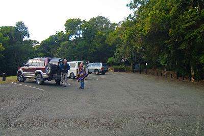
We dropped my Maverick off at Apple Tree Park and Drove Ron and Jo's Jackaroo up to The Settlement Day use area and prepared for the walk.


We Walked off towards the top of Purlingbrook Falls but soon struck our first setback ... they had closed the track !

A couple of workers headed off down the track but we headed off along the other way ... the long way ...and as we passed the next lookout we could see the workers had already arrived at the bottom of the falls but we had yet to tackle the 450 steps down on this route!

While still walking along the top of the cliffs we spotted a Goanna up a tree...

Then after getting to the base of the cliffs we started the walk back towards the base of the waterfall and spied another Goanna ripping a Carpet Snake to bits...


We finally got to the base of Purlingbrook Falls...

We turned left and headed down the creekside track to Warringa Pool, a very tranquil and beautiful spot beside the waterfall.


We crossed over the top of the falls and entered the dense green foilage on the other side and followed the track down stream past rocky gorges and idyllic scenery ...


We came to a set of extremely steep stairs that were almost like a circular staircase as the 91 steps wound their way down to the creek.

No mention had been made of these steps in the maps or track descriptions but worse was to come as we then started the 3.5Km climb back up to Apple Tree park ... with another 532 steps !!

Did I mention I hate steps !!
The climb was pretty relentless but eventually we came out on a Powerline track and followed that for a while past some of the old tree felling remains with their distinctive rectangular slots.

Eventually after 3.5 hours and 1073 steps we arrived back at my car and made a welcome cup of coffee which we drank while watching a segment being filmed for "The Great South East" Tv show with Laurel Edwards hosting.


After our late lunch we picked up the Jackaroo and headed back down the mountain for home ... next time might be the downhill section from Apple Tree park to Numinbah Valley but this time we have read there is over 900 stairs ... i hate stairs !!

29-08-09 10.6 Km [as far as I can work out] 4.25 hours Apple Tree Park to Numinbah Prison.
Jo dropped us off at Apple Tree Park, Ron and I then headed off across the top of the Plateau towards the cliff line...


This sign gives you some idea of what we are about to tackle...

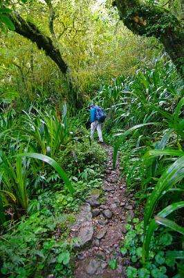
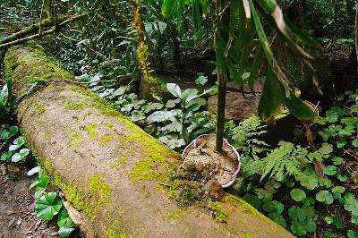
The track then Zig Zags down the side of the mountain useing a heap of steps and even utilising a hollow log for a path...
We talked to a local going down who reckons they ferried in the steps with helicopters, still would have been a heap of work though!


We passed through Grass Trees and Elkhorns up in the tres were in touching distance from the track...


The track leveled out a bit after a Km or so and we came out at Woonoongoora walkers camp [...which has a fancy eco dunny but your not allowed to camp there or have a campfire ...] which sits at the top of cleared paddocks high up the valley...
This camp is marked on the maps but a sign says the camp is 4 Kms away ???


We kept going down hill crossing one small creek and came to a second wider creek crossing with views up the valley to the cliffs in the distance...


As we passed a Farm, the noise of the frogs were making in a small pond was almost deafening, these could be the endangered Fleay's Barred Frog [according to another sign].
We followed the driveway out and then followed Chesters Road for a while where I spotted a Bar-Sided Forest-Skink...

The track dived off the road to the left and we soon passed a temporary walkers camp [where you are allowed to camp]and came out on Murwillumbah Road near the coffee shop after 960 steps, 3.5 hours and roughly 7.3 Kms.
We were a bit earlier than we thought so Jo drove us up to a park for lunch...


the patterns on this tree beside the creek were interesting...

Since we were now out of National Parks and had finished early we decided to take the dog for a walk along the section beside the road from Numinbah Prison Farm back to the coffee shop...


Jo dropped us off and we followed the Path ... while one particular horse followed us until it couldn't follow any more...


We passed this gate and were soon back at the coffee shop after 3.3km and 3/4 hour.

The distances quoted on the National Parks don't seem to work out and i only had a pedometer so its pretty hard to give accurate distances for this section IE: the Literature shows 10.3 kms from Apple Tree Park to Numinbah and 4.8 kms from Numinbah to the Prison farm and Rons GPS lost satellite coverage a lot of the time.
Oh well... at least thats another couple of sections done. :)
03-12-09: 6Km 2.5 hrs Numinbah to Lower bellbird Circuit near Binna Burra.
As noted in the next bit i did this lower section after doing the upper section... I parked the car at Numinbah Prison and walked up to Binna Burra and back down to the car again.
Arriving at Numinbah Correctional Centre at 5.00 AM i parked the car across the creek from the prison and while getting my gear out of the car was approached by a prison guard who asked me what i was doing, when i answered "walking up to Binna Burra and back" he then said "that will take you a couple of days then?" ... i answered i would be back later that day, he was obviously just checking that i did know what i was about to do and wasn't just leaving the car there for some other purpose!!
Setting off i walked across the creek and past the front of the Prison Farm following the road...


I turned right at the edge of the prison and headed into the bush and across a barbed wire fence...


The Prison lies nestled beneath a soaring backdrop of tall cliffs with Egg Rock further up the valley...


It wasn't long before the first of the 350 step appeared as the track climbed up above the Prison Boundary and crossed into the National Park...


I caught the occasional glimps of Egg Rock through the trees before the track decended down to the crystal clear Nixon Creek ...


The creek had a lot of the Blue Quandong fruits floating in its waters...


leaving the creek i climbed the bank and found a road on the other side of the bank..


The road followed the creek for a bit then started to climb steeply ... it kept on and on and on for about 4Km to the Lower Bellbird Circuit intersection...


Because of the thick trees it was impossible to see much apart from the odd butterfly and distant bird ... saw about 3 of these birds in the distance which i think were Brown Cuckoo-Doves ... large crop to get the bird pic.


I came to a clearing where the track joined the Lower Bellbird Circuit ...


This spot was where i would turn around and head back as i had already walked the Lower Bellbird Circuit section a few days previously.
While having a rest I spotted a Tick crawling along my leg ... then a March Fly started biting so i decided it was time to head back down to the car...


The Brown Cuckoo-Dove was still in the tree so i slowly edged closer through the bush but it wasn't long before it flew away and i headed off down the track until i spotted Egg Rock in a gap through the trees caused by a cliff line, i walked across to the top of the cliff for a better view...


Egg Rock overlooking the prison farm...


As i got back to the creek i thought i might just follow the road to see if i could get a better view of Egg Rock through the ferns and trees ...


As i came to a creek crossing Egg Rock became hidden behind a smaller peak that rose straight out of the water...


There was lots of Damselflies flitting around.
Saphire Rockmaster...


Not sure what this is ...


A crop of the two ...


I continued down the road until I came to the prison boundary then turned to follow the fence line up through the bush, the fence went straight up the side of the hill and I ended up cut and scratched from forcing my way up through the scrub ... I was very tempted to jump the fence into the cleared area but thought better of it.
With one last look over the fence at Egg Rock i made my way back to the car happy that another section was complete.


30-11-09: 9.3Km 3 hrs Binna Burra to great walk turn off on Lower Belbird Circuit.
Well, i skipped a section and did this upper section before the lower section of the Numinbah to Binna Burra section as there is 60km by road between the two ends so its a bit hard to get back to the car ... will do it later.
Since i was by myself I decided to do the 9.3 km section from Binna Burra by doing the 12km loop from Binna Burra via the bellbird creek loop and back to Binna Burra. skipping the bit down to Numinbah for now.
Saw this Tawny Frogmouth before first light...

Leaving the Info centre carpark at 4.30AM I headed up the hill towards Binna Burra passing the view down into Numinbah Valley...

there was a little wallaby grazing beside the sign who hadn't noticed me approaching...

I carefully snuck a little closer but he spotted me then took off...

As the sun rose i stepped back into the dark of the rainforest and started the Lower Bellbird circuit stopping at Koolanbiba Lookout for another view of Egg Rock...

i heard some rustling in the leaves and spotted these two lizards...

The rock at Yangahla Lookout looks like it was flowing like a wave then stopped as it was about to crash over ...

The path slips between two large slabs of rock...

These two fruits sitting on a moss covered rock look almost like an animal...

A tree sits in the middle of a creek below a waterfall...


I spotted a Lamington Spiny Crayfish which is only found on the Lamington Plateau ...


The creek tumbles down through small round pools ...

This thin sheet of rock sticks out of the ground like a wall...

The path is quite easy to follow...

The path quite often has a very steep drop on one side...

The path passes a few waterfalls...

Tall cliffs are quite common...


When i arrived at a clearing the "great walk track" branched off down through an old dairy farm but i turned to the left and walked back up the hill to the Info Centre car park arriving at 8.15 am after 12 Km and 3 3/4 hrs.

This section has been the easiest walk so far.
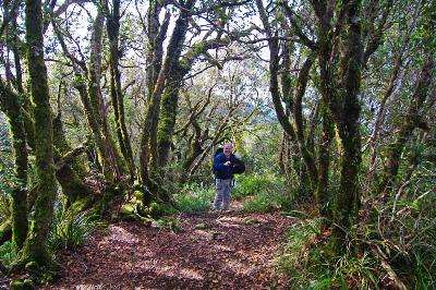
26-06-10: 22Km 8 hours, Binna Burra to O'Reilly's
Jo and Ron picked me up from O'Reillys where i had parked my car before first light and we all headed over to Binna Burra arriving at sunrise.


It was around 10 degrees when Ron and I left the carpark at about 10 to 7, Jo drove back home in the heated comfort of the Jackaroo.
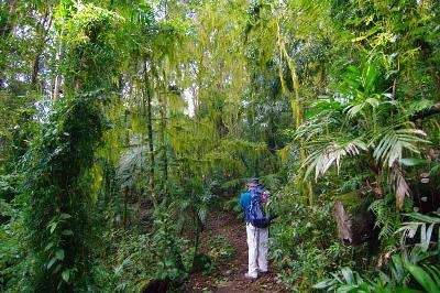
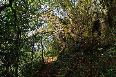
Ron and I headed off on the Border Track into the rainforest...

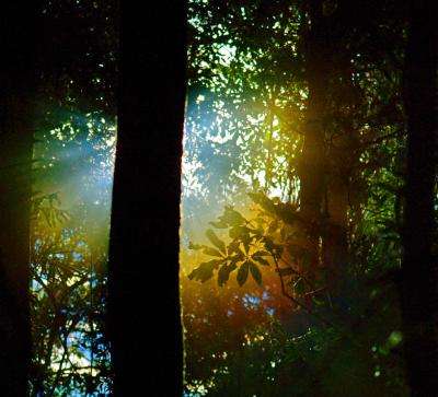
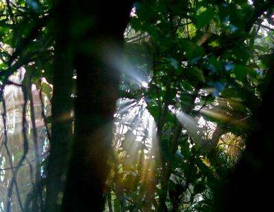
The sun and the mist created circular rainbows...
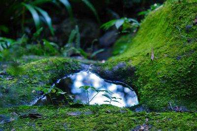
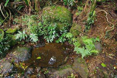
We crossed over several moss covered creeks along the track...
Day was still very cloudy making it pretty dark in the forest..
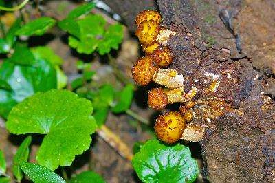
Fungi really loves the dark dampness...
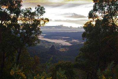
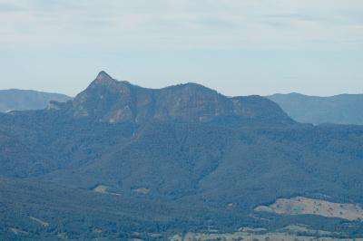
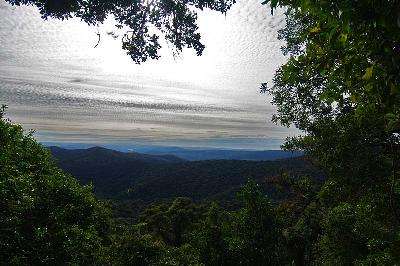
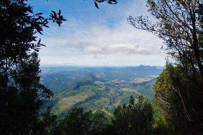
We finally reached the cliff line and were rewarded with a view of Mt Warning in the far distance from a side track to a lookout ...
The Mt Marino lookout was an overhang and was quite disconcerting looking over the edge straight down to the rocks around a hundred metres below ...

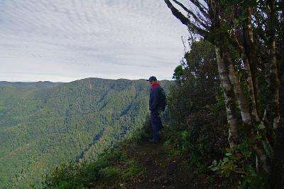
Ron's not real comfortable with unfenced heights ...
We had a lunch break a few metres back from the edge amongst the Artic Beech Trees in a nice little spot, we had been walking for around 3 hours and were ravenous so the wraps Jo had made up for us went down a real treat :)
After lunch we headed off back down the narrow track to join the Border Track ...
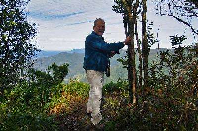
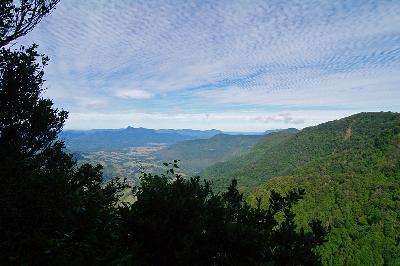
More lookout views from the Mt Marino track...
The Border tracks follows the cliff line occasionally affording more views over the Valley ...
The track gets quite wet and rocky around the creeks ...
The track again goes close to the cliff edge ...
The Border Track then turns away from the cliffs and follows the ridge line back towards O'Reilly's passing a water point where the water comes straight out of the rocks into a small rock pool...
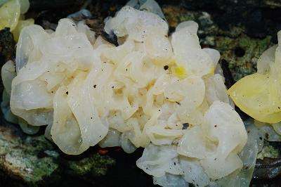
A small tree has grown straight through some fungi ...
We passed some slimy white fungi ...
There was not a great deal to see on the last few K's into O'Reilly's and we were getting a bit sore and tired so it was good to down a cup of coffee to celebrate the finish of The Gold Coast Hinterland Great Walk
We jumped into my car and headed back to Jo and Rons and a luxurious hot Bath to soak away the tired muscles.
Its taken a few weekends but has been well worth the effort to check out the scenery of the Green behind the Gold
:)

1 comment:
beautiful walk i ever done and best place to go.http://surfersrentacar.com.au/family-rental-cars/
Post a Comment