This Highway was not the original route to the Darling Downs though, the earlier route was discovered by stockman Henry Alphen in 1847 and the subsequent road up through Spicer Gap was built in the late 1850’s, its here we get the chance to get the wheels a little dirty and take in some of the serenity and fantastic scenery of the area.
National Parks have closed the central portion of the road to vehicles but access is still available to both ends and you can walk the closed section.
A day use area and Campground is available opposite the site of the old tavern.
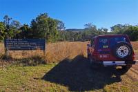
To access the Spicers Gap section head east on the highway from Aratula for 5 Km and turn left then after a further 5.7 Km turn right and follow this road for 3 Km until the road turns to gravel, it is suitable for all vehicle types although the steep gravel section could be a problem in a front wheel drive and 4wd would be needed in wet weather.
2.6 Km later an unmarked lookout on the right is worth stopping for a look as it affords a view over grasstrees to the hills in the distance.
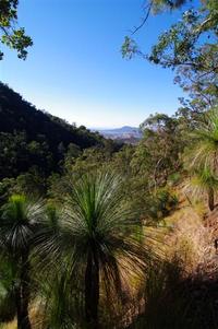
The park boundary comes up a short time later and 1.4 Kms after the lookout we turn left into the picnic area just after the campground entrance.
Although Fires are not allowed in the campground they supply wood fired BBQ’s in the picnic area next door, seems a little strange!
A disabled access toilet sits between the two.
A short walk leads to the memorial of the 13 unmarked graves in the unmarked cemetery, the writing seems to have been done by what appears to be carpet tacks or similar imbedded in the concrete.
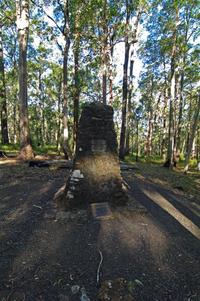
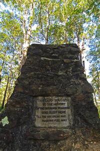
We noticed something white on a hollow tree not far away but upon investigation turned out to be a sign saying “no Geocacheing allowed” … I think I would prefer to “not” see a Geocache hidden in the hollow of a tree than a big national parks sign saying this is where it used to be until it was removed.
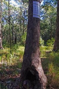
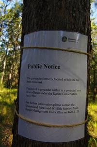
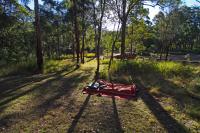
Across the road an orchard has been built on the site of the old tavern but we could not see any old relics from the roadway so we had a look around the campground instead, it does not look well used so should be a fairly quiet and tranquil spot to make camp although the usual National Park bollards make it hard for vehicle based camping.
Mount Mathieson is spelt three different ways by National Parks on signs and pamphlets , Mount Matherson, Mount Matheson and Mount Mathieson but as there is a Mount Matheson in Nightcap national park we can probably discount that one.
The Chief Commissioner of railways was a man named John Mathieson and the nearby peak was apparently named after him so that is the most likely spelling.
The Mount Mathieson Walking track heads past the orchard opposite the campground finishing at the western end of the closed section of road.
The eastern end of the closed road at Governors chair is only 2 Kms away by gravel road.
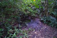
We drove on crossing a deep puddle and stopped for a look at Moss’s Well, a round concrete ring full of fresh water supplied by a nearby spring.
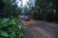
We continued on and it wasn’t long before we reached the carpark and picnic table at Governors Chair where we walked the 150 metres up the stairs to the lookout with spectacular views over the surrounding countryside.
“Governors Rock” as it was first called was named after Governor-General Sir Charles Fitzroy in 1854, perhaps the U shaped rock inspired the name change to Governors Chair?
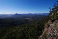
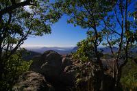
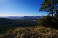
The 1.6 Km closed off section of road begins across the other side of the carpark and has interpretive signs dotted along the way explaining some of the roads construction methods such as Corduroy and Stone Pitching.
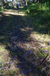
The diversionary embankments used to divert water across the road probably get their name from the term “Whoaboy” used by the bullock drivers when approaching these banks.
After our walk we decided to explore the western end of the Spicers Gap road and made our way back to the Cunningham Highway where we turned left and drove up the range over Cunninghams Gap, we passed the Pacific Petroleum servo and about 1Km later turned left off the highway on an unmarked road that is very hard to spot so keep an eye on your mirror and your speed down as the turn is just after a bend and traffic is all high speed on a downhill highway.
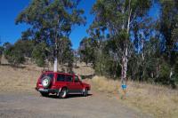
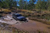
This section of road is suitable for 4WD only but high clearance soft roaders should be OK in dry conditions.
The road passes through private property for about 7Kms and crosses a couple of swampy sections and a creek on its way, just veer right at the Y intersection and go straight ahead at the cross road to get to the carpark at the western end of the closed section of road.

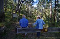
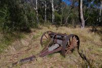
From the carpark it is a 1.1 Km walk to an old Timber Jinker on the Mount Mathieson trail.
Spicers Gap makes a great day out or weekend destination and with such awesome panoramic views and spectacular scenery is well worth the effort to get there.
.Shane Gerrish

1 comment:
Cool Blog, I think I'll go check it out.
Post a Comment