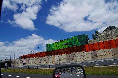
Tuesday 27 dec 2011. This morning i hit the road again and when i got to melb the navigator said to turn right on the metropolitan ring road ... but the sign says it goes left ... so i went left and ended up zig zagging all over the place ... *rolls eyes*
whats with this eastlink mob ... 7 tolls in about 7 Kms
I then hit Doncaster, has so many lights and you have to stop at each of them but they are only 100 metres apart ... *roll*
strewth, and ya reckon Queensland roads are bad
anyway ... finally got out of the city only to have the Navigator keep saying turn left when the road goes right gave up on it and just followed my nose.
Tell ya what, Victorias number plates should read state of confusion, this Navigator can't make head nor tail of the roads ...
came out of a dead end road to a T intersection after looking at a waterfall and the nav said turn right so i did ... then it said make a U turn ... so i did ... then after passing the dead end road it said make a U turn again ...
I gave up and just use it as a map now !!
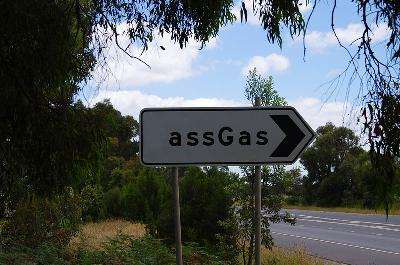
Not sure but i think this sign points to a retirement village for old farts or something ... LOL
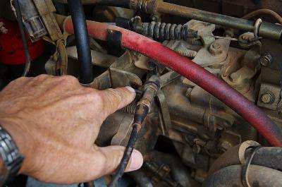
Not long after the mighty MK had its first and only breakdown when i lost most of my accelerator pedal travel ...
felt like a broken throttle cable but it had just fallen out of its bracket.
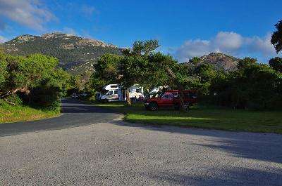
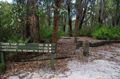
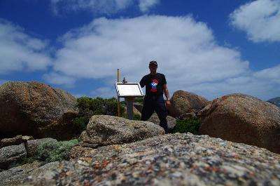
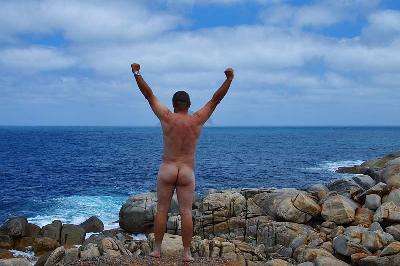
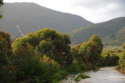
I finally made it down to Tidal River and made camp not far from the beach, this is as far South as you can drive in Australia.
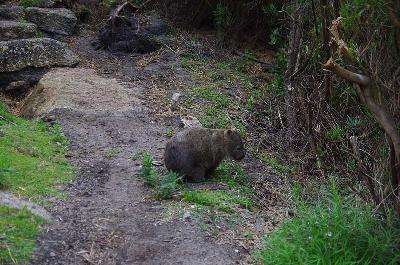
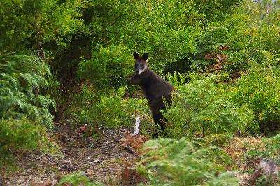
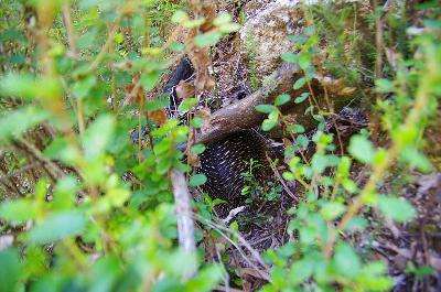
Went for a walk and spotted a Wombat ... i froze and it didn't seem to see me so i grabbed a few pics ...
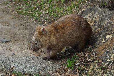
There was another one hanging around camp with eartags that just didn't seem to care if you were in its way ... it just barged through
A couple of guys ran out of water depth and had to carry their boat back to camp ...
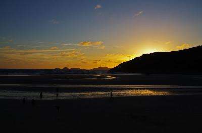
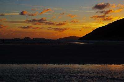
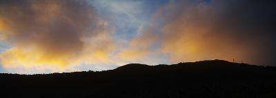
Then after dinner i headed back down the beach for some sunset shots ...
nice place Tidal River [apart from all the people] ...
About 4 am Wednesday as the first light hit the sky i was up and packed my swag then fired the old girl up [a fact i'm sure was appreciated by the surrounding campers] and moved her into the Tidal River day carpark as you have to be off your site by 11:00.
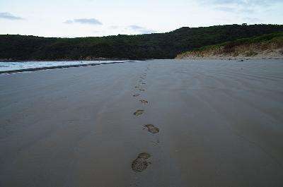
I disconnected the Aux battery to keep the main battery full and packed some gear then hit the beach by about 4:45 am for the walk out to South Point.
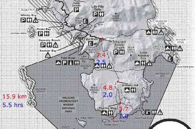
Its a pity the Telegraph Saddle carpark had been closed off as it added about 12 Kms to the trek due to having to walk via Oberon Bay, the longest walk i've ever done was about 25 kms ... but ... i didn't drive 2000 Kms to be stopped by this little fact.
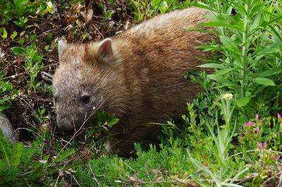
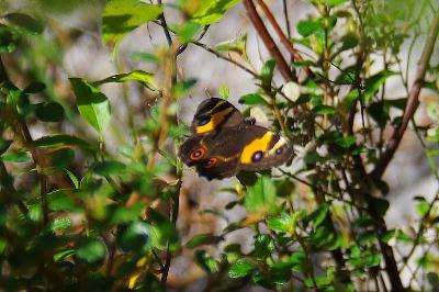
Along the way to little Oberon Bay i spotted another friendly Victorian ...
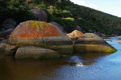
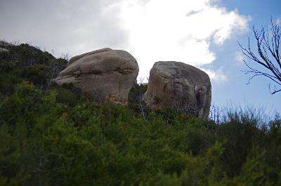
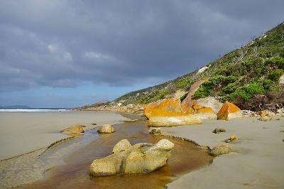
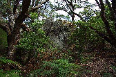
Some pretty impressive rocks around here ...
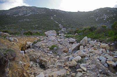
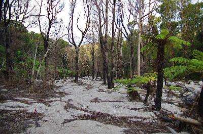
The March flooding rains have certainly done some damage but it was easy to walk around the missing bits of track.
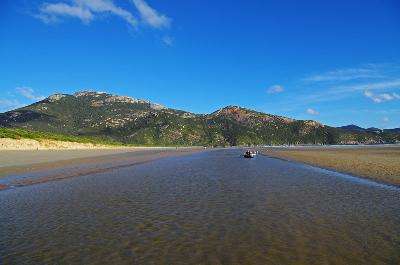
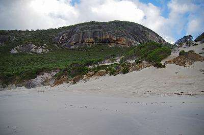
The coastal views were pretty nice ...
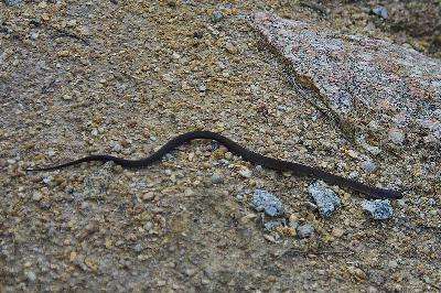
Some of the Victorians are not so nice ... as i stepped through the thick scrub out into a small clearing this little fella reared up to have a go but i stepped back out of range pretty quick and only managed one quick pic before he scooted off ...
Had to cross a creek at Oberon Bay ...
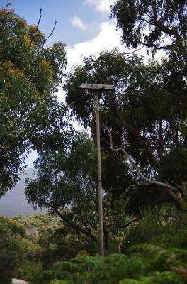
I had a bit of trouble finding the track that leads off inland from here but by climbing a dune i spotted a round metal thing in the thick scrub so i forced my way through to it and found it was the top of the vent pipe to the dunnies and a road was leading inland from that so i was back on track.
one of the friendly Victorians eating some leaves ...
It was about this time i had done 8 Kms and my right knee had blown out so i thought i would hobble on another 3 kms to the Telegraph Track [reminiscence of Cape York] and i could turn left to get back to the Telegraph Saddle carpark and walk back down the road to the car.
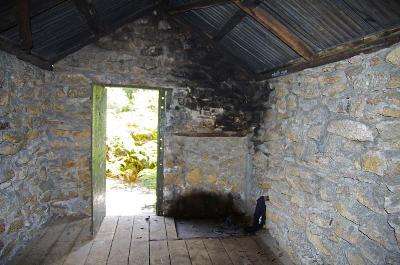
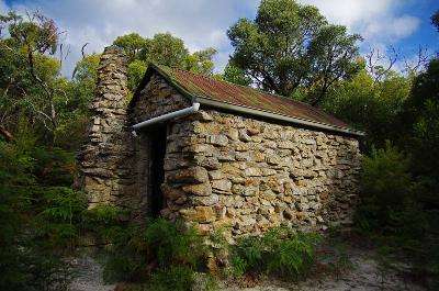
When i got to the intersection on the right i saw a sign to Halfway Hut 1.3 Km and since the knee was no worse i thought i may as well hobble up for a look ...
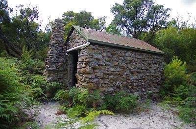
The fireplace has been bricked up ??? good if you get caught out in cold wet weather
One of the burnt Telegraph Poles ...
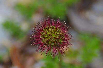
Weird little plant ...
There was a sign saying Roaring Meg a further 4.6Km ... ah what the hell !!
Maybe it wasn't such a good idea, the road was all uphill for the next couple of Kms ...

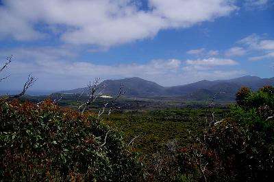
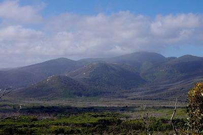
Had some nice views over the valley though...
Roaring Meg eh! couldn't hear a waterfall or anything, there were some big rocks down in the gully but i was too sore to go for a look and it was only 3.7 Kms of track to get to South Point so ....
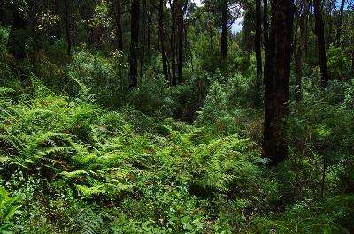
This area has been closed since march so the track was not going to be easy ... yes theres a track in there somewhere ... cmon, its only another 3.7 Km to your destination !!
Along the track the knee go so bad i couldn't hobble anymore so i had to find a sturdy stick to use as a crutch ... xxxx it was bad
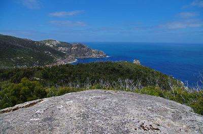
I struggled on and made it to a big assed rock outcrop with some awesome views ... i think there is a lighthouse on the other side of that ridge ...
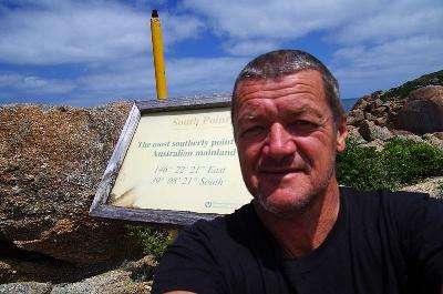
Then finally ... a sign in the distance ...
We'd made it ...
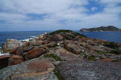
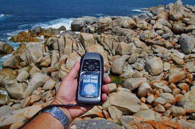
Just in front of the sign is a slightly lower area of rocks that the water could possibly cover on high tide and large seas but the GPS says i could go a bit further so i went another 50 metres or so to a large rock with a sheer drop down to some lower rocks that are obviously covered at high tide.
This looked more like the high water mark to me ...
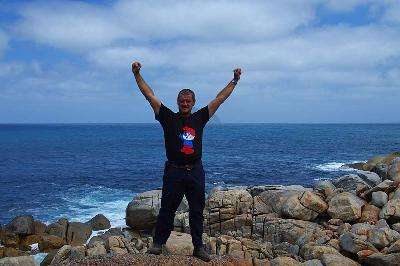
Yep, i reckon i'd made it to the arse end of Australia LOL
Reality really hit home about now ... i had walked 22 Kms to get here but now i had to get back
I sat there for a while hoping a boat would show up but i knew deep down that i was totally on my own out here ... no one else would be along so i had no choice but to start back for the Ute at Tidal River.
On Flat ground i could walk nearly normal but in a fair bit of pain but on the slightest uphill or down hill i had to shuffle sideways using the stick ... it was going to be a long way home !!
I shuffled off back up the hill thinking ... its only 3.7 Kms to roaring Meg ... if i can just make that ...
Along the way i had to pass through the split rock again ...
Then i got passed by an Echidna ...
Wish i could steal his wings ...
I made it back to Roaring Meg then thought "If I can just make it back to Halfway Hut I can sleep there and it has some water as the heavy exertion was really making me sweat" ... its only 4.6Km
The views helped keep my mind off the pain ...
Favouring the right knee had put a lot of stress on the left knee so now it had blown out as well but the pain had been so constant that i was getting used to it ...
I was never so glad to see a Hut ...
I had signal so Rang NannaJo to let her know where i was ... just in case i didn't make it back out.
I noticed that when ever i stopped the pain was really intense until i got moving so thought if i stayed the night at the hut i may not be able to move again ...
I polished off the rest of my food and refilled the water container and set off again.
It was fairly flat going across the valley floor so i was getting along ok until any slight uphills slowed me up ... I crossed over where i had come out of Oberon Bay so the track was all new to me from now on ...
I figured staying on the Road was going to be easier that following the overgrown bushy track in the dark.
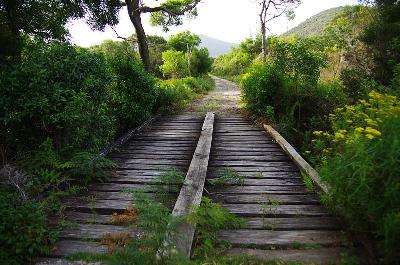
I crossed over Growler Creek bridge ...
When i saw this i thought "If thats the road i'm just gunna lay down and die at the bottom of the hill ... they can pick up my body next year"
Luckily it was just a water damage scar and the road veered round in the next valley going past this cascade of jumbled rocks and sand swept down by the march floods...
It was about here that things got realy bad ...
The road started heading uphill but i though i may have done about 5 Kms of the 7.4 Kms from the hut ... in reality i had only done about 3 but what i didn't know was the next 4 odd Kms was all uphill.
This was one of half a dozen or so washed out corners on the way up...

I struggled on for a while having to stop and lay down every now and then and it was so demoralising to turn a corner and see the road continuing up to another corner ... I wasn't game to look at the GPS to see how far i had come as the hope that i would reach the top around the next corner kept me going ...
A close up view of what i thought was a road ... man that water did some damage ...

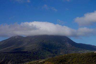
It was getting dark by now so i put the camera away after this pic of Mt Oberon ...
On and on I went shuffling sideways up the steepest bits but the pain was so intense i kept collapsing and had to use every bit of will power to get back up again.
The thought that this would be the last corner kept me struggling on and despite the freezing cold wind i was sweating like a pig ... i felt for sure that i had already passed that 7.5Km mark but still the road kept going up and up ... I was past feeling the pain but just could not get my knees to bend under load so my hips were aching, my calf and upper leg muscles were burning and my arm muscles were killing me from lifting myself forward with the stick.
Shuffle shuffle, shuffle shuffle, one foot after another till i almost walked past a set of steps that led to the Telegraph carpark ... I had made it to the top and promptly collapsed on the bitumen.
After a bit of a rest i knew i had to get going again as i had no idea how far it was back to the ute but at least it was down hill.
Problem was i couldn't get up !
There was a pile of old pallets nearby so i dragged myself over to that and levered my way upright ... after a bit of wobbling i headed down the road in the dark.
The roadway had been damaged severely all the way down the hill but at least it was a fairly flat surface and the pain wasn't affecting me as i'd gone through the wall.
The gradient wasn't too bad and i could walk in a straight line rather than shuffle so i was making good time and after 3 Kms made it to the closed gates at the bottom of the hill.
All i wanted was my bed and i was hoping it wasn't too far on the flat ground back to the car so i doggedly kept plodding along for another 2 Kms until i finally hauled my sad and sorry arse back into the Ute at around 10 Pm.
A big group of teenagers were blueing near the ute and half a dozen Rangers and the local cop was there so i thought i had better move on ... i drove out of the park and pulled up on the side of the road and slept Like a baby.
It had been 42 Kms ... isn't that a Marathon distance? ... it was sure a marathon to me !!
*Continued in part three*

No comments:
Post a Comment