View Larger Map
06-07-08:
The Hay Valley Track will cut through the westernmost southern corner of Queensland near Poepel Corner, the junction of South Australia, Northern Territory and Queensland.
Our intention is to travel northwards up the extremely remote Hay River Track in the Northern Simpson Desert to where it first drops into the Hay River Valley then turn in a south south east direction and follow the valley down until we encounter the QAA line.
Permission to travel over the uncharted and trackless terrain has been approved after giving full details of our purpose, intentions and our intended start and finish GPS reading although these were only aproximate readings due to a lack of detailed maps of the area.
We will be searching for signs of a route taken by nomadic Aboriginals and photographically documenting any evidence as well as the local Flora and Fauna.
John will be driving his well set up Toyota 80 series wagon while i will be piloting my Nissan GU Patrol ute.
Finding the route will not be easy as the last signs of the ancient dry bed of the Hay River will be the starting point for our trek.
Just to make things a little more interesting, three days ago i damaged my spine [slipped disc] and was unable to walk but its healing fast and i can get around quite well, if very slowly, with minimal use of the crutches.
With seven days before we leave i expect to have minimal problems getting around as long as extreme care is taken.
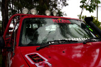
When i arrived back home after convalesing for a few days i found a palm frond had swung down and smashed the windscreen ...
08-07-08:
Gary from River City Auto Glass fitted a new screen to my bent and buckled old Patrol.
I was seriously worried that the body would "spring" and distort the opening due to me rolling it during one of the competition i raced in but the new screen fitted in fine.
09-07-08:
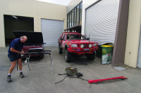
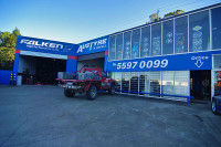
Considering we are about "to boldly go where no one has gone before" i thought it wise to start with some new tyres.
I have been running 35x12.5x15 Maxxis Bighorns over some extreme terrain as well as bitumen for a couple of years now with no punctures or tyre problems so i headed down the Gold Coast to see Brett at Austyre.
HAY VALLEY TRACK 2008
11-07-08: Friday.
John arrived at work and waited until I finished sending out the orders then we headed to the servo at Ormeau to fill up and check tyre pressures then hit the road about 3:00 pm.

By the time we passed through Warwick the sun was showing us a magnificent red sunset and we were finally out of the traffic so we had a good run to Goondiwindi and stopped to refuel.
Just before Moree we tried a side road for a campsite with no luck ... Johns driving lights all stopped working as well and we ended up driving to about 15 Kms past Moree before we found somewhere to pull up.
We found a spot not far off the highway with plenty of wood which was just as well as the temperature was very cold.
While checking things over on the Ute I noticed the fridge had stopped working and so I pulled it apart to check it over with a meter but it looks like the electrics have failed as I have 12 volts to the end of the plug lead.
The Temperature had dropped below 3C by this stage so I just opened the lid for the night.
12-07-08: Saturday.
We awoke to a crisp white frost and were not too keen to get out of our swags until after 7:00,

by 8:00 the temperature had risen to 1C so we started packing and rearranging things while waiting for the swags to dry off then hit the road about 9:30.
Along the way we passed 3 different mobs of cattle and a mob of sheep following the stock route but nothing much else happened until just past Walgett where we stopped for lunch.
After lunch we drove to Bourke and refuelled then headed for Wanaaring.
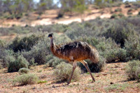
This Emu crossed the road in front of us.
Not long after airing down to 26PSI at the start of the dirt I surprised a Roo who bounded along in front of me for about half a Kilometre as there was a fence keeping him on the road, as I passed him to try and get a photo he doubled back and crossed the road behind me.
A short time later we set up camp on a side track around 4:30.
Plenty of wood around but the campsite was covered in small round holes that we were hoping were only made by Termites.


13-07-08: Sunday.
Once again we awoke to a frost on the swags and hung around the fire until about 10:00 before hitting the road.
The road across to Tibooburra was taken at a very relaxed pace and we arrived in town then filled up with fuel before taking a look at the replica of Sturts boat ... when you gaze around at the boulder strewn terrain you can see it was a pretty useless exercise to drag it all the way out there.
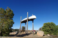
We had enough time to explore Golden Gully and Dead Horse Gully


before heading towards Cameron Corner and stopped a few K’s out of Tibooburra in a dry creek bed.

John found one side of his new fridge slide's locking guide has broken the weld off but it will still hold in place ok for now.
We found a good spot to camp with plenty of wood so we cooked up a great lamb roast in the camp oven ... pure luxury!!

We still had a good phone signal so we checked in to let people know where we were and caught up on the phone calls we had to make before rolling out the swags on the sandy bed of the creek.
14-07-08: Monday.
We were up before dawn as the sun didn’t rise until 7:30 our time and managed to get moving by 9:00 with our first stop being the old shearing shed at Waka where we stopped for a look around at the old machinery.
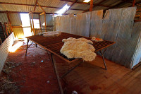

Next stop was Cameron Corner for photos and lunch, while packing my gear back in the truck Hungry walked up and said g’day and then came over to the Corner Shop for lunch and to say g’day to John as well.

We hit the road again and had an easy run to the old Double Decker Bus where we stopped for a gander

before continuing on until we saw one of the Bean Pumps close to the road and stopped to take some pics as it lazily kept on pump its oil.

We took the short cut through to Innamincka which saw us dodging a hell of a lot of water lying in the track but made it through without getting the tyres wet at all.
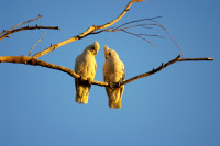
We had a much appreciated [and needed] shower at the public facilities opposite the store then took the road out of town towards Coongie Lakes and pulled up near Scrubby Camp on Cooper Creek to raucous disapproval from the Galahs and Little Corellas lining the trees beside the creek bank.
15-07-08: Tuesday.
The morning sun brought out the birds along the north branch of Cooper Creek so we took the opportunity to grab a few pics before packing up and heading off to Coongie Lakes.
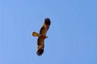
We took the right hand turn to the lake side drive and headed out to see what we could see ... as we crossed over the top of the dune we were stunned to see such a large body of water in the middle of a desert.
We followed the drive having to cross a deep section of water between two lakes to be able to continue on the track,
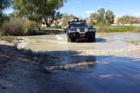
as we got near the end we noticed a set of cattle yards in the middle of a lake under about a metre of water, quite an unusual sight, John reckons it was to hold the ducks!!
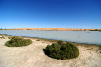
At the end of the track we walked out past some shell middens which we noticed are everywhere around the edges of the lake and got a good view of the size of the lake from the top of a dune on the water’s edge.
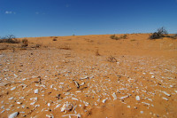
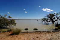
We spied a likely camp spot on the way back and then headed out to the end of the main track for a look then after a walk out to the end of the spit
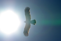
we headed back to our chosen campsite and set up before heading out for some sunset shots.
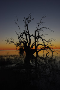
After dinner we went spotlighting but saw nothing but a few small spiders even though the dunes all around us are covered in tracks of every shape and size.
The breeze was very chilly so we had a reasonably early night tucked up in our warm swags.
16-07-08: Wednesday.
It was 4 degrees as we packed up

so we were glad to hit the road back towards Innamincka stopping at the outstation relic along the way.
The meathouse was built under the water tank to allow the cold water from the overnight cool to drop its cooler air into the meathouse.
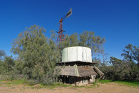
It was not much further when I noticed a strange noise but all I could find was a loose tow hook so kept going intending to fix it later.
One of the grid crossings was quite high so I hit the brakes to slow down and heard a very large bang from underneath and pulled up for a look only to find the front right brake calliper had fallen off due to the two large bolts that hold it in place vibrating off on the corrugations.
I rummaged through the tin of front end bolts and managed to find the correct bolts so I was back on the road a couple of minutes later.
We had shower when we got back to Innamincka then a bit of lunch while I tightened up the driving lights and checked for other loose stuff before hitting the road to Cordillo Downs for a look through the old historic Woolshed and some of the old machinery.

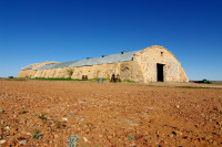

We then drove off towards Birdsville skirting some wet and boggy sections until Providence Creek where we pulled up for the night in time to collect some firewood and have a wander with the camera.
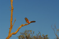

Mossies were really bad but it was still not a bad place to camp.
17-07-08: Thursday.
While rolling up his swag John found this little fella underneath.
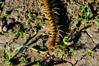
We had a bit of stuffing around with John’s fridge slide as the plug was getting pushed out of line when putting the fridge away but a bit of repositioning and some packing got it working OK and we were soon on our way.
Our first stop along the road was Caldelga Ruins where we had a good wander around
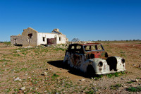
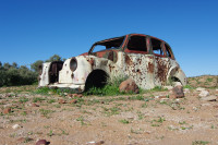
then it was back to dodging old mudholes until we crossed the border into Qld and the roads improved markedly.
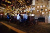
We arrived at Birdsville in time for a counter lunch at the pub then refuelled, restocked and returned to our travels.
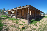
Just out of Birdsville we hit a 450mm deep patch of water then a few Kms later had quite a large patch of water to cross
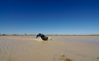
but were soon at Big Red and turned to travel along the base until we found a suitable campsite then spent the rest of the afternoon taking photos.
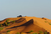
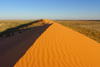
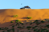
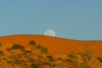
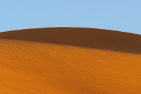
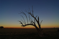
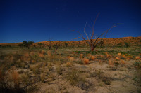
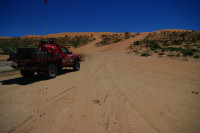
The temperature seemed to be much warmer and we didn’t need to put a jumper on until well after dark.
18-07-08: Friday.
We were up before dawn to get some sunrise pics
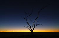
then packed up and headed to the climb over Big Red, we crossed the dune and skirted the big muddy section on the western side before starting the journey to the end of the QAA line.
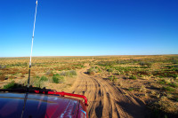
Eyre creek was dry so we had no real problems on the drive passing about 16 vehicles travelling east on the 4 hour drive to the K1 line turn off.
The recent school holiday traffic had chopped up the dunes a bit and the corrugations were pretty bad in places
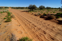
but none of the dunes required a second go although the new Tough Dog shocks were getting a work out due to the constant dips, i was getting some thumping from the front shocks which i think is caused by the thread on the bottom pins not being long enough to take the play out of the rubbers.
When we arrived at the K1 line we turned right and headed up to the Poeppel oil well for a look then continued north for a look at the Beachcomber oil well.
From this point on the track follows the valley for a short while then turns right onto an old shot line and gets really rough for the next 15 Kms or so until we reached the Glove turn off where we turn left and follow the valley past some terrific red dunes,

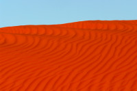
we made camp just before we crossed into the next valley among a small group of Gidgee Trees.
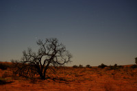
Once again we have seen plenty of tracks but no sign of wildlife except the occasional bird.
19-07-08: Saturday.
Any looseness in components out here really magnifies and becomes a big problem rather quickly so I borrowed some big washers off John and found some big spring washers and fitted them to the bottom of the front shocks to take up the slack and stop them thumping.


We continued up the Hay River Track until we got to the Eagles Nest as we wanted to make doubly sure we were in the Hay River Valley before we started the Track.

We back tracked to the Claypan where the sign points the way to Poepel Corner and placed our sign beside it pointing to the south with the Northerly wind really howling and blowing heaps of dust around.

The start of the Hay Valley Track is at the Claypan at S25.01.808 E137.53.912 and heads up the valley in a South Easterly direction while the Hay River Track heads in a North then south west direction around the end of the sand dune in one direction and in a north west direction in the other direction.

We drove about 1.2Km down the valley and met up with some other travellers camped in a group of trees who had found this spot well off the normal track to try and find some releif from the wind so after chatting for a while we continued on down the valley with the going starting to get very very hard.
The moguls were up to 500mm high in places

and we were slowed to a virtual crawl as we bounced and bucked, rocked and rolled and generally were well shaken by the time i staked the first tyre at 10kms.

The recent rains had covered the place in long grass and the wildflowers were just about to start making a show but it was hard trying to pick the easiest line and we had to cross from side to side following the flattest sections we could.
We passed Camel Claypan at about 14Km and could see heaps of camel tracks and dust baths, the smooth section only lasted for 100 metres or so and we were back into the moguls again.
We found another claypan at the 19km mark after 2 hours on the track and made camp as there was plenty of firewood and a bit of shelter from the incessant wind.
The wind finally dropped off at around dark and we had a pleasant night around the campfire.

20-07-08: Sunday.
The wind picked up again overnight but had changed to a Southerly and covered everything in a fine layer of dust and making for a broken nights sleep but a great day for a Sunday drive.
The rear left tyre on my truck was flat but we could not find a leak and just pumped it up again.
We packed and headed South East up the valley again with more of the big moguls and slow crawling for the first few hours before we had the occasional smoothish section where we could get into second gear.
We stopped to have a look at the bones of a Camel that had not survived, it gives you a strong sense of the remoteness and our vulnerability in this harsh environment.

We crossed the border into Qld and stopped to mark the exact spot and hoist a flag on a star picket.

We kept crossing over a distinct camel path in the bottom of the valley whenever it was clear enough to fit the vehicles through and eventually came across the odd claypan enabling us to get to third gear for a short stint ... pure luxury!!
After around 7 hours of driving we had covered 73Kms and found a sheltered spot in a horseshoe bend of a dune and made camp there in time to get a bit of photography in while cooking up a lamb roast.
While wandering around I was very surprised to find a dragonfly hiding in a bush.

21-07-08: Monday.
We awoke to another flat tyre but this time it was on Johns car which was something we did not expect as my truck was the lead vehicle all the way down the valley and we expected all the flat tyres to happen to it.
We headed across the tail end of a low rise towards a large red dune then turned at the base of it and followed a claypan for a short while before getting back to dodging sharp sticks and huge holes for the first few Kms but then the country started to open up and we followed a camel path until we were only a couple of Kms from the QAA line and then we came across some vehicle tracks and followed then for a while until they disappeared over a dune and a short while later came to the QAA line.
We put up a sign and took the usual photos to celebrate the completion of the trip where we had travelled 106 Kms over 10 hours of actual driving with three flat tyres and no other problems over some very harsh and unforgiving terrain.
We had found no signs of Man at all and although we had seen plenty of tracks in the sand we only glimpsed two lizards at a distance, a mob of camels through some trees before they took off, one dragonfly and several spiders.
There was nothing out of the ordinary in regards to the flora either.

Reluctantly we turned east for Birdsville and drove the 81 Kms back to Big Red

We took some video of us driving the climb then pumped up the tyres again for the gravel road back to Birdsville for a celebratory drink.

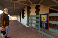
We booked in to the caravan park for a well deserved shower.
We refuelled and restocked then headed to the pub for dinner while planning the next destination of our trip.

22-07-08: Tuesday.
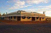
Late night/early morning “revellers” and early morning “getting back at them ers” meant we had stuff all sleep so we were up and on the road early ... to the pub for pics.
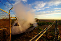
We stopped ouside the Power Station for John to fix a water leak ... no not this water leak, this is helping cool the artesian water.
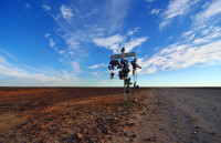
We then hit the road for Bedourie stopping at the boot sign for pics
then Cocoory ruins for a cuppa
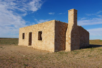
before refuelling at Bedourie.
We back tracked a bit
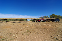
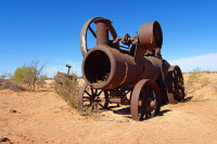
then turned left along the Diamantina Development Road and a short while later stopped at an old bore for lunch.
Amazing how they drag this thing all the way out there to drill a bore then just leave it there because its to hard to take it back.
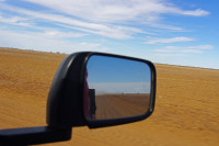
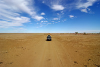
At around 144kms from Bedourie we turned left and headed for Diamantina Lakes travelling through some vast open plains devastated by drought and having a hard time keeping up the pace through the soft dirt, I spent most of the time in fourth gear to keep it up around 80kmh.
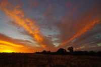
We made camp in a small creek bed and was treated to a spectacular sunset to end the day.
23-07-08: Wednesday.
We drove to the Ranger station but there was no one around so we headed off to Hunters Gorge which was cut by a large waterhole and backed on to a small flat top range cleft by a myriad of small ravines.
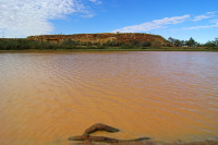
We then drove down to the Gum waterhole to look at the foliage lined expanse of muddy water then drove out the Winton road
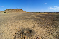
to Janet’s Leap which turned out to be a very spectacular range of views from the top of the jump ups overlooking a heavily treed valley to the jump ups on the other side .
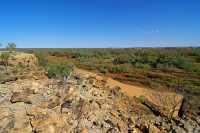
A muddy brown creek ran past the base of the cliffs which runs into Hunters Gorge.
Behind us the view was over the flat country with several isolated flat topped hills and was by far the best part of the whole Diamantina Lakes area.
The next several Kilometres was flanked by more of the jump ups and was very spectacular scenery and we had a look at the ruins of the Mayne Hotel
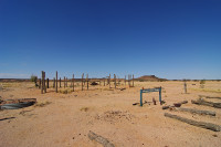
just before we stopped for lunch with a backdrop of the rugged escarpment curving around behind us.
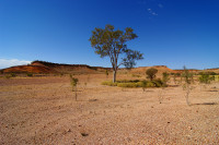
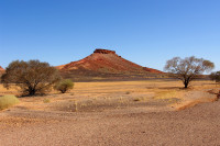
After lunch we drove out of the escarpment country and into the flat plains
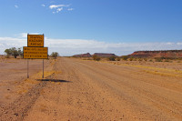
but we were hit by unexpected rains about 100kms from the blacktop and had nowhere to go but try and keep it in the middle of the road and keep moving.
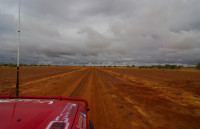
At first the tyres hardly made a mark but we were sliding on a slippery surface layer but as the rain started to soak in it became a sticky mass of heavy soil that clogged the wheel arches and sapped so much power that I was down to second gear working extremely hard and overheating badly.
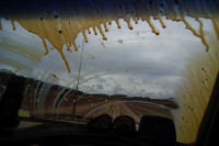
The poor old patrol was drinking fuel like it was going out of fashion but there was nowhere to pull up and the edges of the road and in particular the plains were a bottomless morass of sticky mud so we either had to camp in the middle of the one lane road in the mud or try and keep going.
I stopped on top of one of the grids for the radiator to cool down and allow the sub tank transfer pump to try and catch up a bit [the Patrol was using more fuel than the transfer pump could transfer over] then once again hit the mud until I finally caught up with John at the Bitumen about 50Kms out of Winton.
As we drove in to town we dropped into the BP to fill up and found Al there so we stopped for a meal and a coffee to catch up before searching the town for a room finding one of the last ones at the Tattersalls Hotel as not only were the roads closed but there was some footy event and also the camel races on the coming weekend.
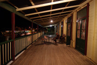
24-07-08: Thursday.
We had a very cold night and were awake early so we packed up and went for a walk around town while waiting for the sun to come up, this bloke has a very unique gate and wall around his place.
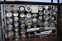
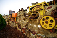
then decided to move the trucks before the shop keeper turned up and saw our trucks making a big mess in the parking bays outside his shop.

We dropped in to the BP again for breakfast and finally found out that Serena is not a figment of Al’s imagination as we actually got to meet her ... either that or Al hired here for the morning to act as his missus!
We said our goodbyes and thanks for their hospitality and then tried to wash the mud off but a three trailer road train was using the truck wash so we hit the road for Longreach mixing it with all the Road Trains and Caravans.

We toured the Stockman’s Hall of Fame
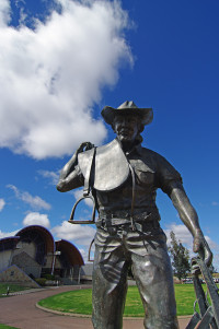
which we both found very interesting then once again made tracks stopping to camp just north of Blackall.
John spied an Echidna trying to hide in a hole in a tree and we were a bit worried he would get stuck so we left him alone for half an hour and he was gone by the time we got back.
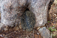
The Ground was still very soft as one fella found out when he tried to drive across the grass in the road side stop we had camped in, we had something to watch for a while as he winched the van out backwards back onto the bitumen.
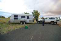
25-07-08: Friday.
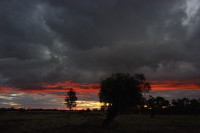
We had a bit of rain overnight so Johns swag got a little wet and we put it on the table to dry while we had a cuppa and watched the Currawongs invade the campsite, I had noticed last night that the light would not work in the fridge power outlet so I plugged the fridge into a different outlet …. Yep … you guessed it … it works fine … DOH!!
We then we hit the road for the long drive home.
Wish we could have ended the trip at Winton after all the excitement instead of having to put up with all the boring bitumen on the drive home.
Was a great trip though and John was excellent company making it a very enjoyable couple of weeks.
Might be a bit hard to make the next trip more remote and challenging though!
Can’t wait!!
.Shane Gerrish
Fuel Figures
0000.00: Ormeau filled up for start of trip.
0365.60: Goondiwindi 58.59 lt $1.80.9 $105.99 365.6 km 16.00lt/100km
0953.10: Bourke 101.01 lt $1.99.0 $201.01 587.5 km 17.19lt/100km
1380.60: Tibooburra 84.19 lt $2.13.8 $180.00 427.5 km 19.69lt/100km
1752.40 Innamincka 59.49 lt $2.21.9 $132.01 371.8 km 16.00lt/100km
2422.00 Birdsville 129.27 lt $2.05.0 $265.00 669.6 km 19.29lt/100km
(Also topped up sub tank 15.9 litres $33.01)
2951.20 Birdsville 128.37 lt $2.08.0 $267.01 529.20 km 24.25lt/100km
3138.50 Bedourie 29.39 lt $2.11.0 $62.01 187.3 km 15.69lt/100km
3793.60 Winton 153.77 lt $1.89.9 $292.01 655.01 23.47lt/100km
4480.70 Morven part fill only 118 lt $1.92.0 $227.00
5201.00 Home 173.35 lt $1.75.9 $304.92 21lt/100km [problem with injectors]
Video by 4WDTV :)
